The Massachusetts stretch of the Connecticut River is some of the easiest big-water paddling in New England. Most of it is impounded behind two dams (the Turners Falls dam in the north and the Holyoke dam in the south), which means long, broad, glassy reaches with little current outside spring runoff. A canoe, a kayak, or a paddleboard, a life jacket, and an afternoon are enough.
The river’s public boat-launch and paddle-access network is Connecticut River Greenway State Park, a chain of eight DCR-managed access points scattered along twelve miles of shoreline from Northfield down to Chicopee. Defer to the Greenway entry for the current list of put-ins and take-outs; this guide is a primer on the three reaches paddlers in the Pioneer Valley actually use.
North: Barton Cove (Gill)
Barton Cove in Gill is the classic put-in for a first paddle on the river. The cove itself is a quiet arm of the Turners Falls impoundment: flat water, forested banks, and a long peninsula of conifer woods sheltering you from whatever wind there is on the main channel. FirstLight Power, the hydroelectric operator, runs the recreation area here, including a seasonal canoe and kayak rental at the boat launch and a small campground at the base of the peninsula.
The cove is also one of the better places in the Valley to see bald eagles. A nesting pair re-established at Barton Cove in the early 1980s (among the first to return to Massachusetts after the DDT-era collapse), and the tall pines at the tip of the peninsula have held a nest most years since. Look up.
The launch is off Route 2 in Gill, a few minutes east of the Turners Falls bridge. Downstream from the cove, the French King Bridge carries Route 2 across the river. It’s a 782-foot, three-span steel cantilever-arch bridge 135 feet above the water, visible from the upstream paddle if you head north toward the Northfield line.
Munns Ferry and the Northfield Mountain reach
The reach upstream of Barton Cove, behind the Turners Falls dam, is operated by FirstLight as part of the Northfield Mountain recreation area. Two outposts on the river belong to the rec center: the Pavilion at 156 Pine Meadow Road, a post-and-beam picnic shelter on the riverbank available for rental in season, and Munns Ferry, a paddle-in-only canoe campsite further north.
Munns Ferry is a quiet way to spend a night on the river. There’s no road in, you arrive by canoe, and the campground is small and reservation-only through FirstLight. The same outpost rents canoes seasonally for day trips on the impoundment.
This is also the reach where flow matters. The Northfield Mountain pumped-storage plant pumps water up from the river at night and weekends and lets it back down on weekday afternoons; releases at the Turners Falls dam below the cove can change the surface noticeably. Check FirstLight’s release schedule before launching, especially in spring runoff.
Mid-valley: Sunderland and Hatfield
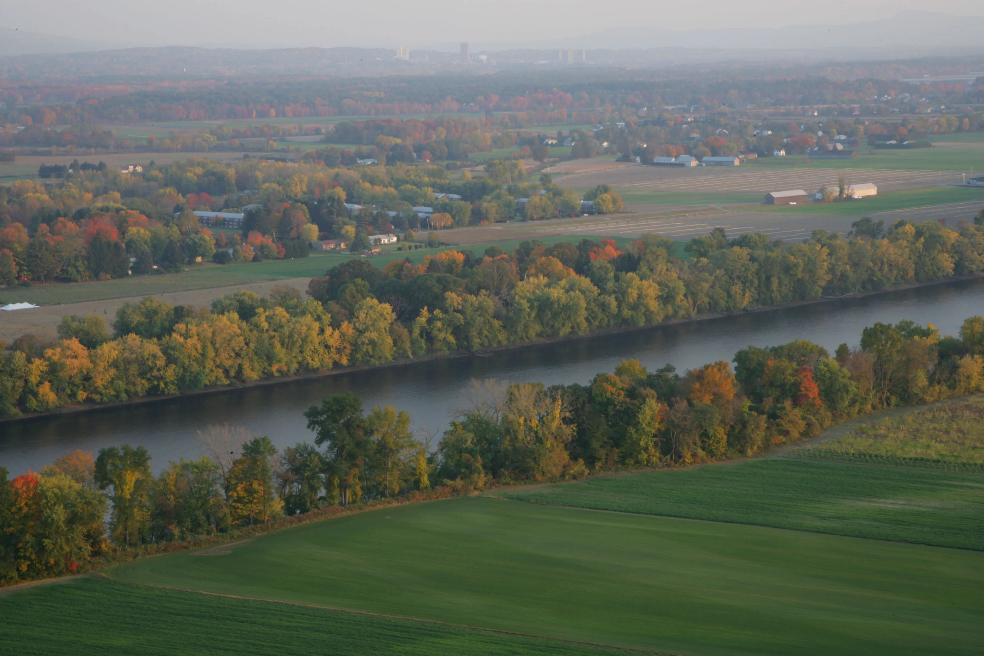
South of Turners Falls the river breaks into a free-flowing stretch before slackening again behind the Holyoke dam. The most popular day-paddle on the Massachusetts river is the seven-mile reach from Sunderland south to Hadley, which threads the gap between Mount Sugarloaf on the west bank and Mount Toby on the east. The Greenway maintains canoe-and-shallow-draft access at both Sunderland and Hatfield, and a wheelchair-accessible launch at Elwell in Northampton. The reach is broad and slow, with farm fields and forested banks alternating along the shore and the trap-rock ridges of the Pioneer Valley closing in on the horizon.
Shorter out-and-backs work well from any of these put-ins. The Hatfield access is a small lot and a walk-in launch across a sand bar; Sunderland is a small lot just off Route 47.
What to bring
- A life jacket for every paddler. Wear it.
- Sunscreen and a hat, since the river is unshaded and the water reflects.
- Drinking water and a snack.
- A dry bag for phone and keys.
- Closed-toe water shoes if you’ll be putting in across mud or a sand bar.
- A change of clothes in the car.
The river looks placid and is, mostly. Spring runoff (April into early May) moves quickly enough to matter, and the impoundments above and below carry their own currents when the dams are running. First-time paddlers should stick to Barton Cove or the Sunderland reach in summer, when conditions are most consistent.
Practical notes
- Outfitters and rentals. FirstLight rents canoes and kayaks seasonally at Barton Cove and at the Northfield Mountain river outposts. Hours and rates change year to year, so check the FirstLight site before driving up.
- Seasons. April through November is the practical paddling season. Most Greenway parcels aren’t plowed in winter.
- Releases. Above the Turners Falls dam, check the USGS Montague gauge and FirstLight’s release schedule. Below the Holyoke dam, flow is dam-controlled.
- Eagles and wildlife. Beyond the Barton Cove pair, ospreys nest along the river and great blue herons are common in the slack reaches.
- Fishing. The river holds smallmouth bass, pike, and a returning shad run; Massachusetts inland fishing licenses apply.
For the full access-point list and current river conditions, see the Connecticut River Greenway State Park entry, the source-of-truth for where to put in.