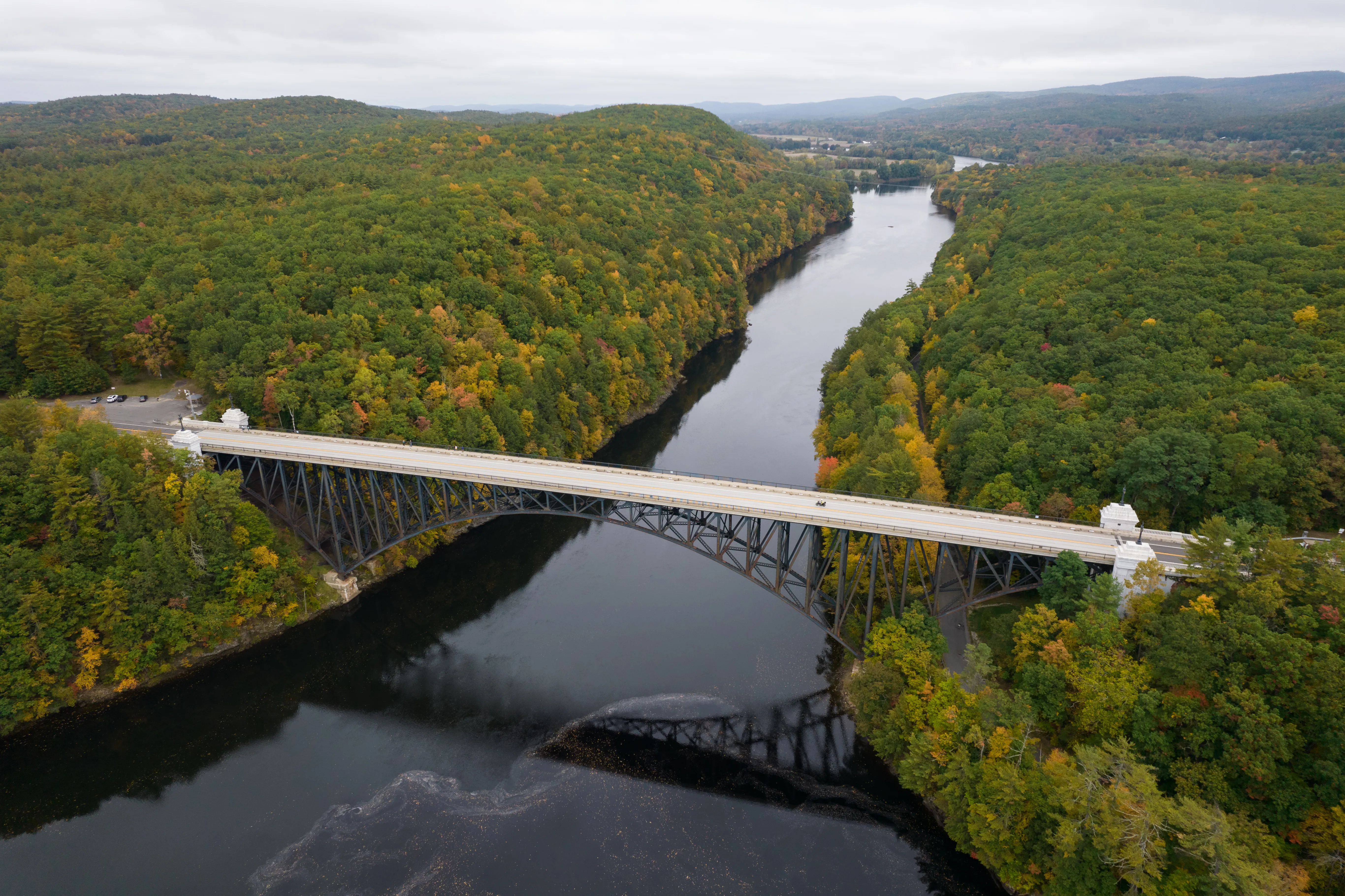
The French King Bridge is the dramatic three-span steel cantilever-arch bridge that carries Route 2 (the Mohawk Trail) across the Connecticut River 135 feet above the water at the Gill–Erving town line, where the river bends through the steep-sided cut known as the French King Gorge. It opened to traffic on September 10, 1932, and at 782 feet it is one of the longest and most recognizable river crossings in western Massachusetts.
The bridge was specifically designed without piers in the water. The gorge is too swift and too important to the downstream hydroelectric system on the Turners Falls impoundment to allow them, so the steel arches were built outward from each bank in cantilever and joined in the middle. The American Institute of Steel Construction named it the Most Beautiful Steel Bridge of 1932, and it remains one of the most-photographed bridges in New England.
What to see
- The bridge itself: a slender three-span deck-arch structure in dull green-gray paint, with the long center span leaping the gorge between two shorter flanking arches.
- French King Rock: the outcrop in the middle of the river just upstream of the bridge that gives the gorge and bridge their name, visible from the deck in low water.
- The pull-off: the French King Rock scenic pull-off on the south (Gill) end of the bridge gives the canonical river-level view back across the gorge.
- Pedestrian sidewalk: the bridge carries a sidewalk on one side, so you can walk out over the water for the long view down the Connecticut.
Visiting
The bridge is on Route 2 between Gill and Erving, about ten minutes east of downtown Greenfield. Park at the French King Rock pull-off on the south end (the stone-walled overlook on the Gill side) and walk back out onto the sidewalk for the full view; there’s also a smaller pull-off on the Erving side. There is no admission and no gate; the bridge is viewable at all hours, and fall foliage views in early to mid-October are spectacular.
For more along this stretch of the Connecticut, the Barton Cove recreation area on the Turners Falls impoundment is a few miles downstream in southern Gill, and the Northfield Mountain trail network sits on the ridge above the river just upstream.