Gill is a small Franklin County town of about 1,550 on the west bank of the Connecticut River, where the river bends sharply between two trap-rock ridges through a steep-sided cut known as the French King Gorge. The town was settled in 1776 and incorporated in 1793, named for Moses Gill, the Massachusetts lieutenant governor at the time. Gill is bounded on three sides by the river (Northfield across the upstream reach, Erving on the gorge, and Montague at the Turners Falls dam), and on the west by Greenfield across the Fall River.
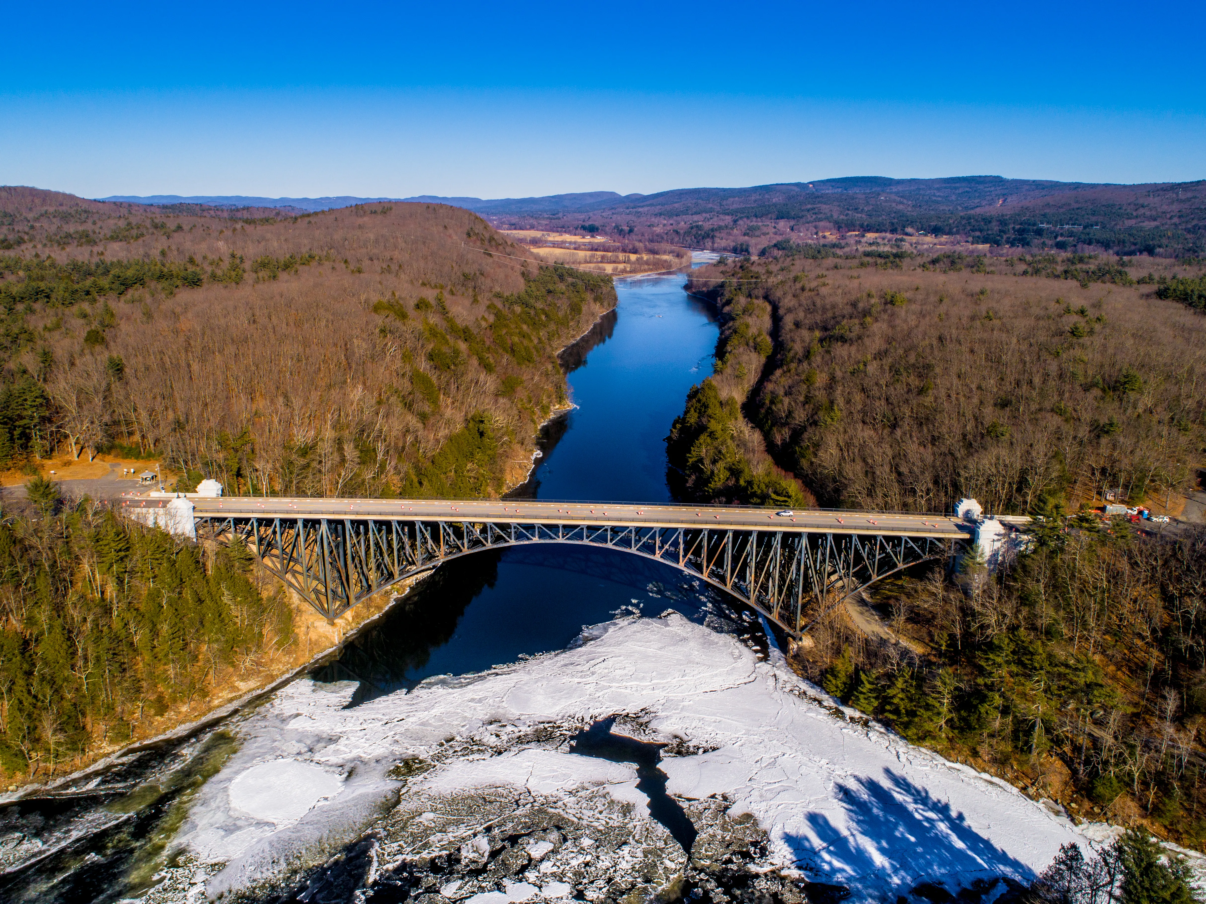
The French King Bridge
The hero image is the French King Bridge, the dramatic three-span steel cantilever-arch bridge that carries Route 2 over the Connecticut River 135 feet above the water at the Erving– Gill town line. Opened to traffic on September 10, 1932, the bridge was specifically designed without piers in the water (the French King Gorge is too swift and too important to the downstream hydroelectric system to allow them), so its arches were built outward from each bank in cantilever and joined in the middle. The American Institute of Steel Construction named it the Most Beautiful Steel Bridge of 1932, and it remains one of the most-photographed bridges in New England.
Northfield Mount Hermon School
The Mount Hermon section of town, on the high ground above the river, is the campus of Northfield Mount Hermon School, the merged 1971 successor to D.L. Moody’s Mount Hermon School for Boys (founded here in 1881) and his Northfield Seminary for Young Ladies. The school consolidated all instruction onto the Mount Hermon (Gill) campus in 2005; the roughly 1,350-acre property (buildings, athletic fields, and woods) makes up much of the town’s southern half.
Barton Cove
At the south end of town, where the Connecticut River widens behind the Turners Falls dam, the Barton Cove recreation area on Route 2 is the public launch and campground at the upstream end of the impoundment. It is one of eight access points along the Connecticut River Greenway State Park, with paddling, fishing, and a small seasonal campground operated by FirstLight Power.
Peskeompscut
The riverbank in southern Gill, opposite the falls in
Turners Falls, is the site of the Peskeompscut–Wissantinnewag Native fishing camp where Captain William Turner led a colonial militia attack on the morning of May 19, 1676, during King Philip’s War, killing between 100 and 200 people, mostly women and children. The site is addressed in the interpretive material at the Great Falls Discovery Center across the river and in ongoing work by the Nolumbeka Project, which centers the descendant community’s framing. A small commemorative marker stands on the Gill side of the river near where the attack began.
Other notes
- Gill has no village center in the conventional New England sense: no compact common, no main commercial street. Town life is spread between the Riverside neighborhood near the dam, the Mount Hermon campus, and the small farms and houses along Main Road.
- The town has a small public library (the Slate Memorial Library on Main Road) and a working dairy and produce farm presence, including the Upinngil Farm, store, and bakery in the north part of town.
Sources
- Town of Gill
- Gill, Massachusetts — Wikipedia (2020 U.S. Census population: 1,551)
- French King Bridge — Wikipedia
- Northfield Mount Hermon — official site