Mount Toby rises east of the Connecticut River across from Mount Sugarloaf, forming the long forested ridge that closes the north end of the valley around Sunderland. The summit, at 1,269 feet, carries a steel fire tower that the state keeps open to the public. The climb adds the last 50 feet of elevation and opens out to a full 360° view: the Connecticut River and the Pocumtuck Range to the west, the Holyoke Range and Quabbin to the south, the hilltowns to the east, and the Vermont border country to the north.
The forest and who owns it
Most of the land that hikers use is the Mount Toby Demonstration Forest, a 755-acre UMass Amherst teaching, research, and demonstration forest. The trail network stitches that acreage together with adjoining private timberland (primarily W.D. Cowls land), and the boundaries are mostly invisible on the ground. The mountain is famous for its biological diversity: botanists have logged dozens of fern species (local lore puts the count near forty out of the roughly forty-five native to the state) and several rare orchids, including showy lady’s slipper.
Trails
The most-used route up is the Telephone Line Trail, an old service road that climbs steadily for about two miles from the Reservation Road trailhead in Sunderland to the fire tower. It is the simplest route to follow and the easiest underfoot, especially when the rest of the trail network is wet. The 47-mile Robert Frost Trail also crosses the summit, so a full loop or through-hike is possible if you have a car shuttle or a willing walking companion.
Aside from the Robert Frost Trail and the Telephone Line, blazes elsewhere on the mountain are spotty, so bring a map or download an offline copy.
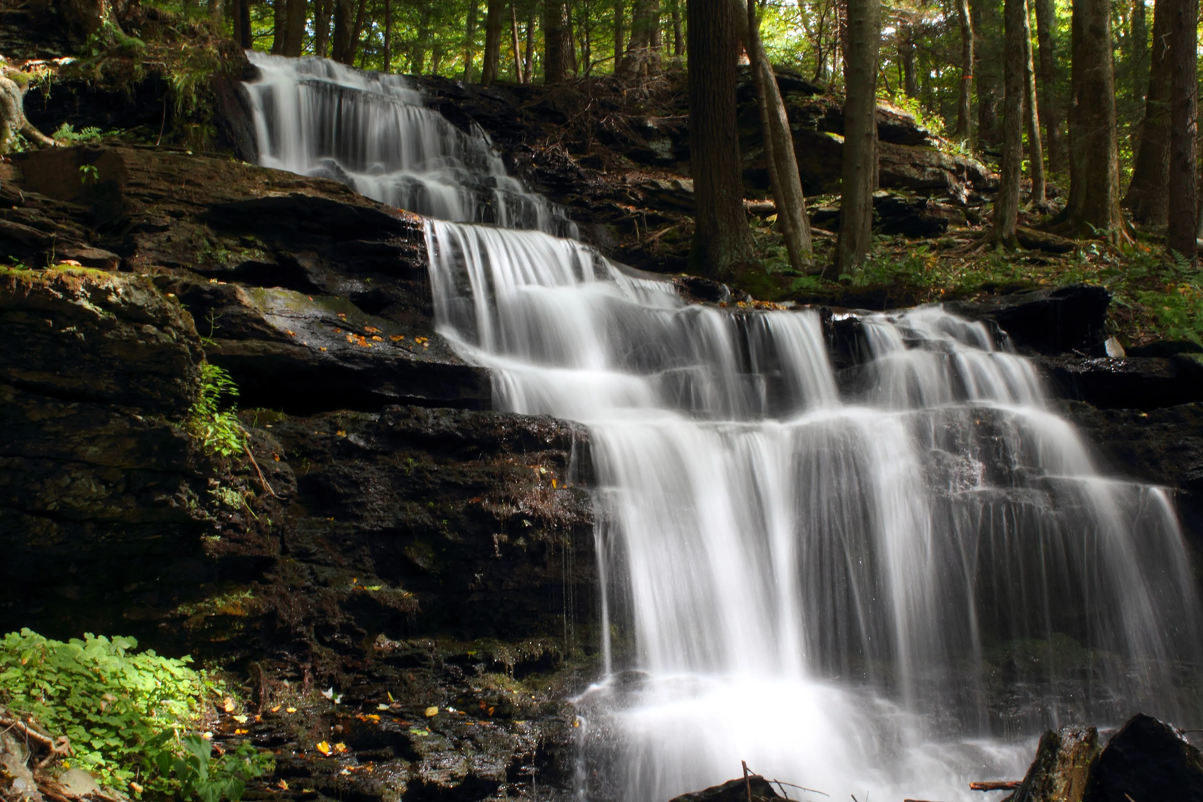
The waterfalls and Cranberry Pond
Several streams drop off the mountain’s flanks, and the lower trails on the south and east sides take in a string of small cascades: Gunn Brook Falls (pictured), Slatestone Brook Falls, Roaring Brook Falls, and several smaller drops. They run hardest in spring snowmelt and after summer thunderstorms.
Cranberry Pond, a small glacial kettle on the mountain’s eastern shoulder, has a marshy fringe and a short loop trail around it. The pond is a good spring birding spot.
What to know
- Trailhead: Reservation Road in Sunderland, off Route 47 a mile north of the town center. Look for a small dirt lot on the right; it fills early on summer weekends.
- No facilities: no bathrooms, no water, no ranger. Bring out what you bring in.
- Active forestry: because much of the mountain is working timberland, expect to share the trails with the occasional logging truck and to find recent skidder ruts on lower routes.
- Hunting: open to deer hunting in season; wear blaze orange in November.