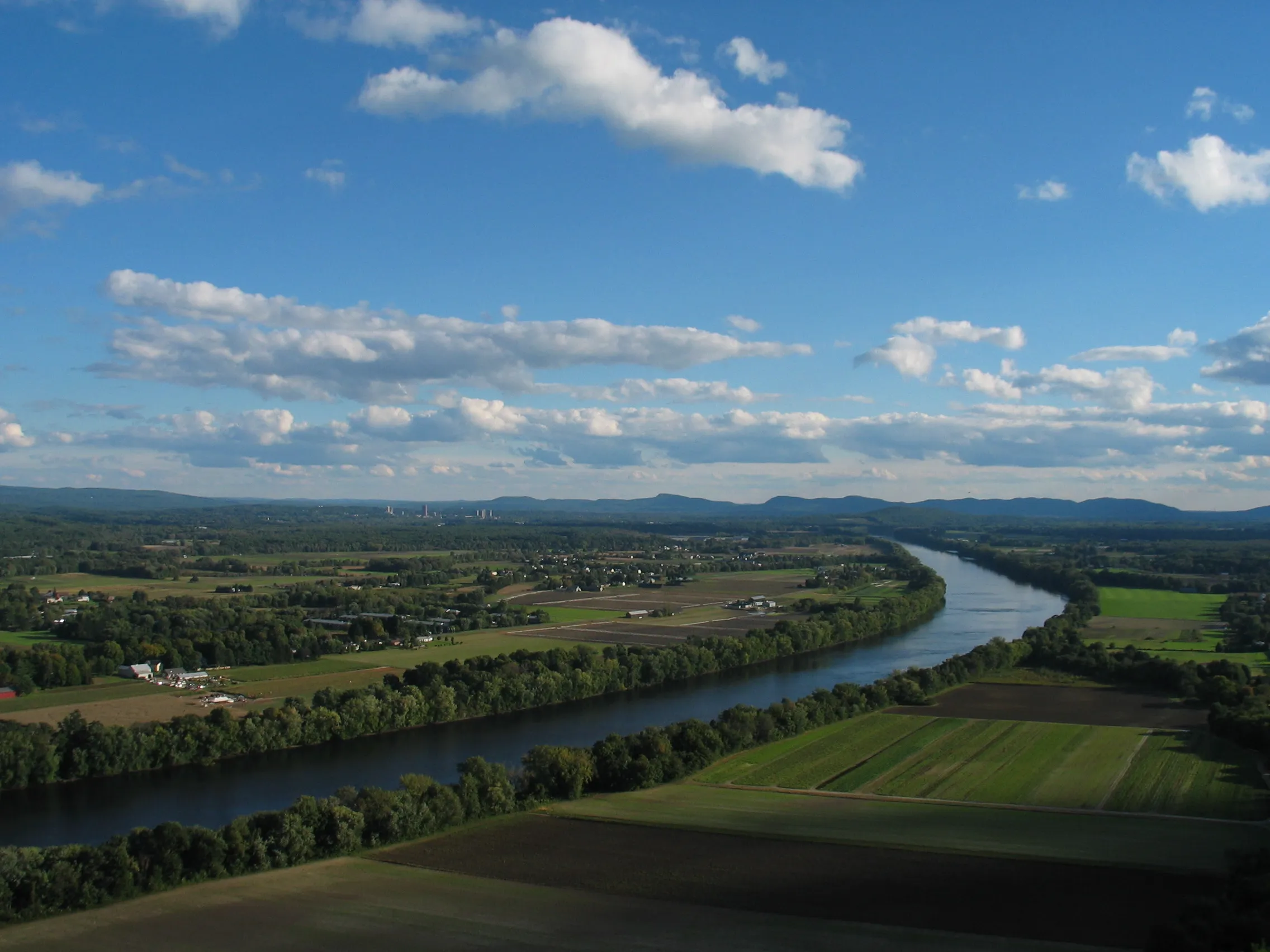
Mount Sugarloaf State Reservation sits at the north end of the Pioneer Valley in South Deerfield. The reservation holds two summits: South Sugarloaf (652 ft) with its open cliff face and observation tower, and the wooded North Sugarloaf (791 ft). South Sugarloaf is the draw: the view from the deck spans the oxbows of the Connecticut River, the patchwork of Deerfield and Hadley tobacco fields, and the Holyoke Range on the southern horizon.
Getting up
A paved seasonal auto road climbs to the South Sugarloaf summit lot, typically open from mid-May through mid-October, 9 AM to sunset. A short, steep hiking trail from the base-of-road lot reaches the same summit in about 25 minutes; a longer ridge trail connects to North Sugarloaf.
What to know
- Observation tower: two-story wooden deck at the South summit. Open whenever the auto road is open.
- Parking fee: DCR lists 2026 summit parking fees from May 23 through October 12 at $5 for Massachusetts-plated vehicles and $20 for out-of-state vehicles; the base pull-off is free year-round.
- Off-season: auto road gate is closed, but the hiking trail remains open to foot traffic.
- Best light: late afternoon sets the ridge face in golden light; sunrise shows the river mist.