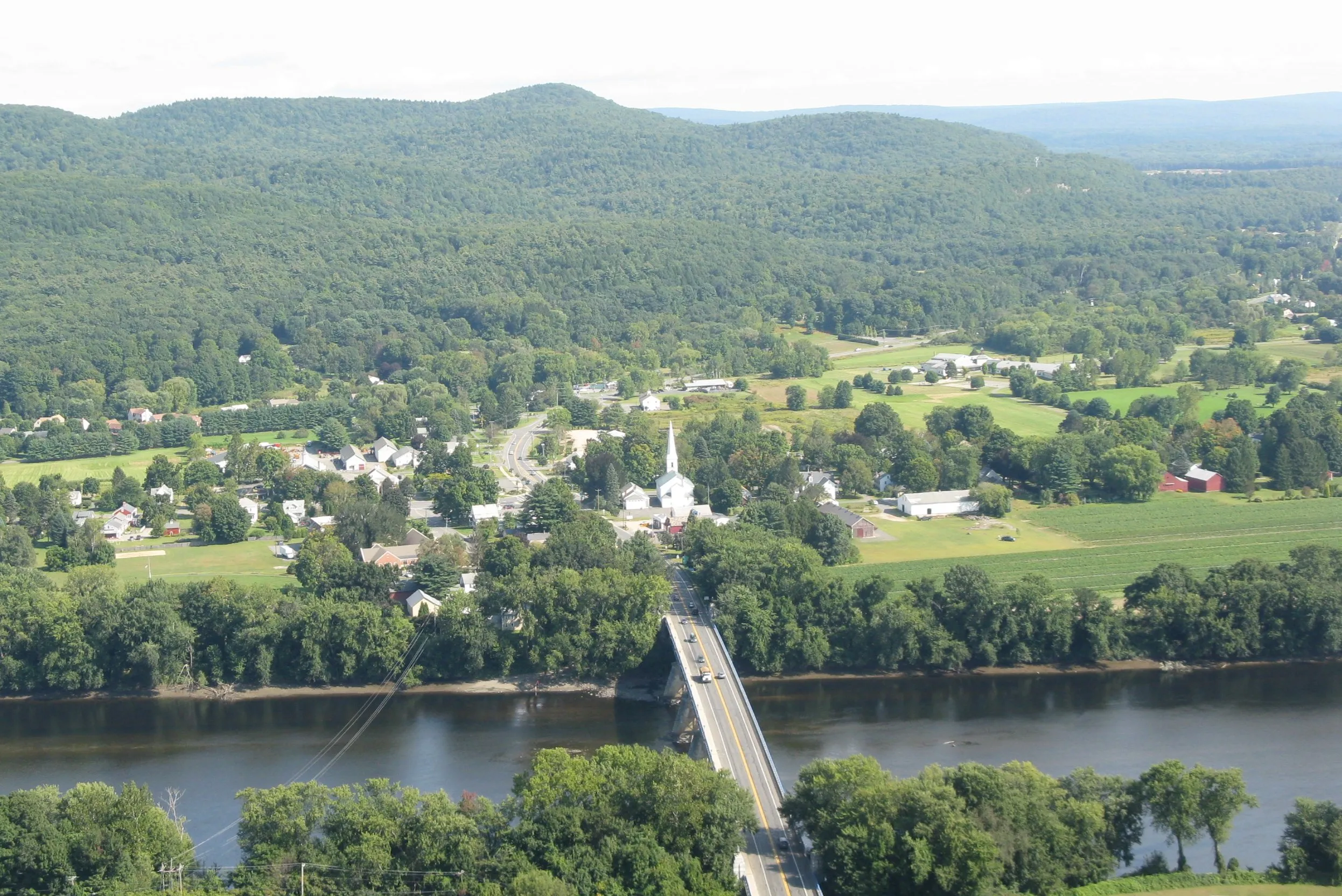
Sunderland is the narrow strip of Connecticut River farmland between the river and Mount Toby, in Franklin County. It was settled in 1713 and incorporated in 1718; the same parcels that were under cultivation then are mostly still under cultivation now. The town center is a single intersection at Routes 116 and 47, with the Sunderland Bridge crossing the river west into Deerfield and Route 47 running south along the riverbank toward Amherst.
The Common and Main Street
Sunderland has the longest continuous town common in Franklin County, a single grass strip running for the better part of a mile along North and South Main Street. The First Congregational Church (organized 1718, current building 1836) is the visual anchor in the middle, white-clapboard with a tall spire visible from miles around.
A few houses north of the church, the Buttonball Sycamore, named for the spiky seed balls American sycamores drop in autumn, has been measured at roughly 90–110 feet tall and around 25 feet in trunk circumference. Local tradition puts the tree’s age at over 300 years, which would make it old enough to predate the town’s founding. It is one of the largest American sycamores in New England.
Farms and the river
The flat ground east and south of the village is some of the most productive farmland in the Valley: the same Hadley loam soil as neighboring Hadley, with similar crops: tobacco (still grown here in shade barns), sweet corn, asparagus, strawberries, and a long list of greenhouse vegetables. The town runs an agricultural preservation restriction program that buys development rights at 80% of assessed value, which has kept most of the open land open as housing pressure from the colleges has built up over the last fifty years.
The Connecticut River forms the entire western boundary. The Sunderland Bridge (Route 116) is the main crossing, a steel truss span that anchors the town’s western view.
Mount Toby
The eastern third of the town rises into Mount Toby, the 1,269-foot mountain Sunderland shares with Leverett. Most of the public-access trailheads are on the Sunderland side, off Reservation Road and Cranberry Pond Road. The summit fire tower is open to the public and gives a 360° view that takes in the village, the river, and the Holyoke Range to the south.
The college-adjacent edge
Sunderland’s southern boundary touches Amherst, and a band of mid-century apartment complexes along Route 116 just north of the line houses a meaningful share of UMass and Five-College student renters. The result is a small town with one foot in seventeenth-century farming and one foot in twenty-first-century college life, sometimes in the same household.
Sources
- Town of Sunderland, Massachusetts
- Sunderland, Massachusetts — Wikipedia (2020 U.S. Census population: 3,663)