Deerfield is two villages on the broad Connecticut River floodplain in Franklin County: Old Deerfield, the museum-anchored historic district at the north end of town, and South Deerfield, the larger commercial village six miles south where most town offices and services are. The land between is some of the most productive farmland in Massachusetts, a flat alluvial plain that has been under continuous cultivation since the 1670s.
Old Deerfield
The historic district along The Street (Old Main Street) is a National Historic Landmark and the centerpiece of the town’s identity. Roughly a mile of pre-1800 clapboard houses runs north to south, most of them lived in or maintained by either Deerfield Academy or the Historic Deerfield museum.
Historic Deerfield operates eleven of the houses as a museum complex with a single admission ticket, focused on the decorative arts and material culture of the early Connecticut Valley.
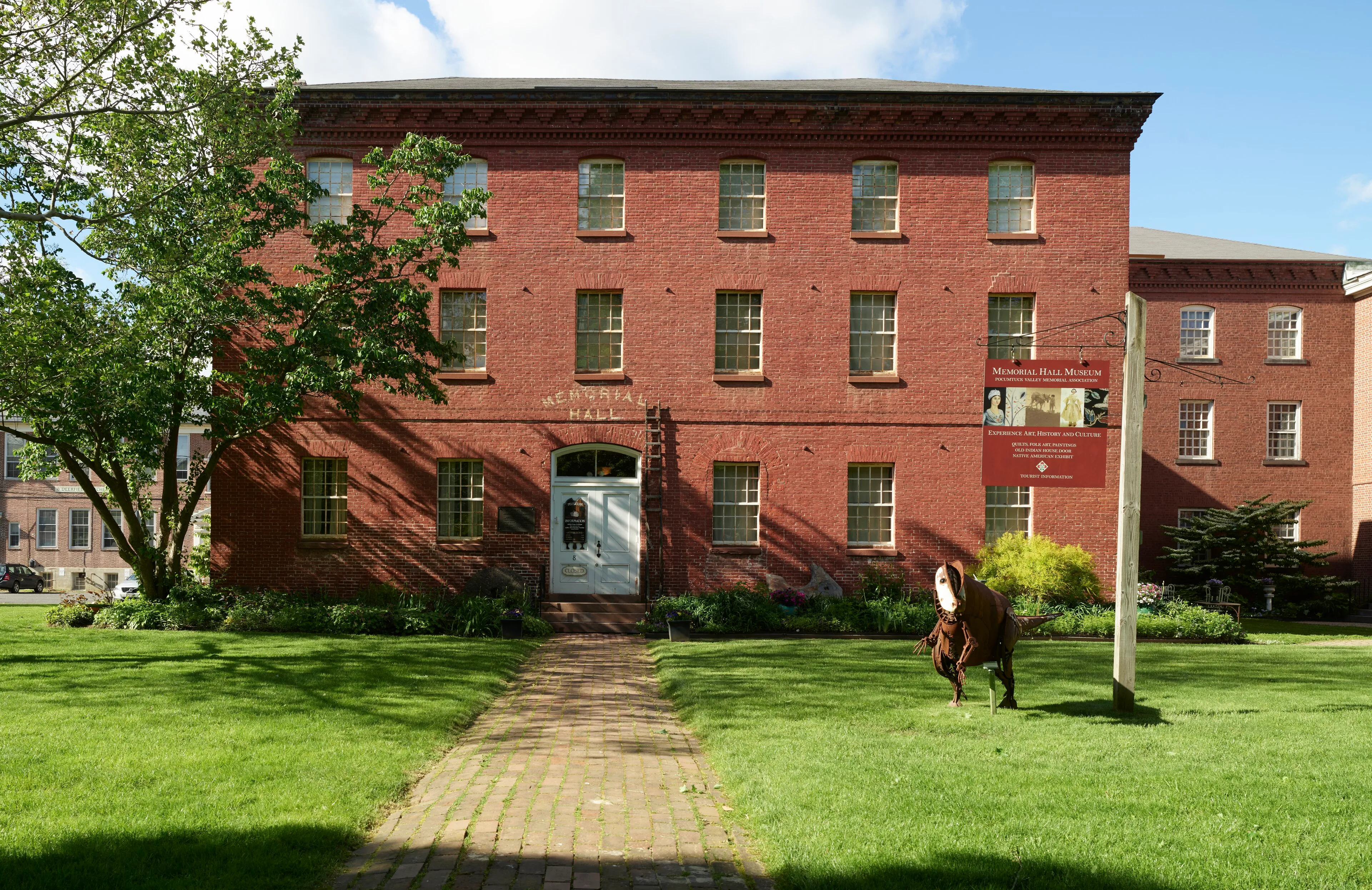
Memorial Hall Museum, a separate institution run by the Pocumtuck Valley Memorial Association, sits at the south end of The Street in an 1798 brick schoolhouse and has been collecting regional artifacts since 1880. It is one of the oldest historical society museums in the country, and the source of much of what’s known about the 1704 raid on Deerfield and the early colonial frontier.
Deerfield Academy, a private boarding school founded in 1797, occupies the rest of the village. Its campus is woven through the historic district and the lines between school and museum buildings are not always obvious to visitors.
South Deerfield
South Deerfield is the working village. Routes 5 and 10 run through it, the post office and town hall are here, and most residents live in the surrounding neighborhoods rather than along The Street.
Mount Sugarloaf State Reservation, on the village’s eastern edge, has an auto road to a summit overlook that takes in the entire south Valley: the Connecticut River below, the Holyoke Range on the horizon, and Deerfield’s farm fields in between.
The Yankee Candle Village flagship store sits on Route 5 just north of the South Deerfield center; it draws steady regional traffic year-round and especially around the holidays.
Getting outside
The Deerfield River joins the Connecticut River along the town’s northern edge. The lower miles, below the Route 116 bridge, are flat-water paddle territory popular with kayakers in summer.
The Connecticut River farmland between the two villages is open country mostly, with the Pocumtuck Range rising as a low ridge to the east. The Pocumtuck Ridge Trail, a hiking trail that runs along the ridge, connects Mount Sugarloaf north to Pocumtuck Rock above Old Deerfield.
Sources
- Town of Deerfield, Massachusetts
- Deerfield, Massachusetts — Wikipedia (2020 U.S. Census population: 5,090)
- Historic Deerfield
- Pocumtuck Valley Memorial Association / Memorial Hall Museum