Colrain is a small Franklin County hill town of about 1,600, set in the North River valley along the Vermont line at the northwestern edge of the Pioneer Valley region. The town was first settled in 1735 as “Boston Township No. 2” (its early settlers were largely Scots-Irish families from Ulster) and was officially incorporated on June 30, 1761, named for Lord Coleraine, an Irish peer. It is bounded by Halifax and Guilford, Vermont to the north; Leyden to the east; Greenfield to the southeast; Shelburne to the south; Charlemont to the southwest; and Heath to the west.
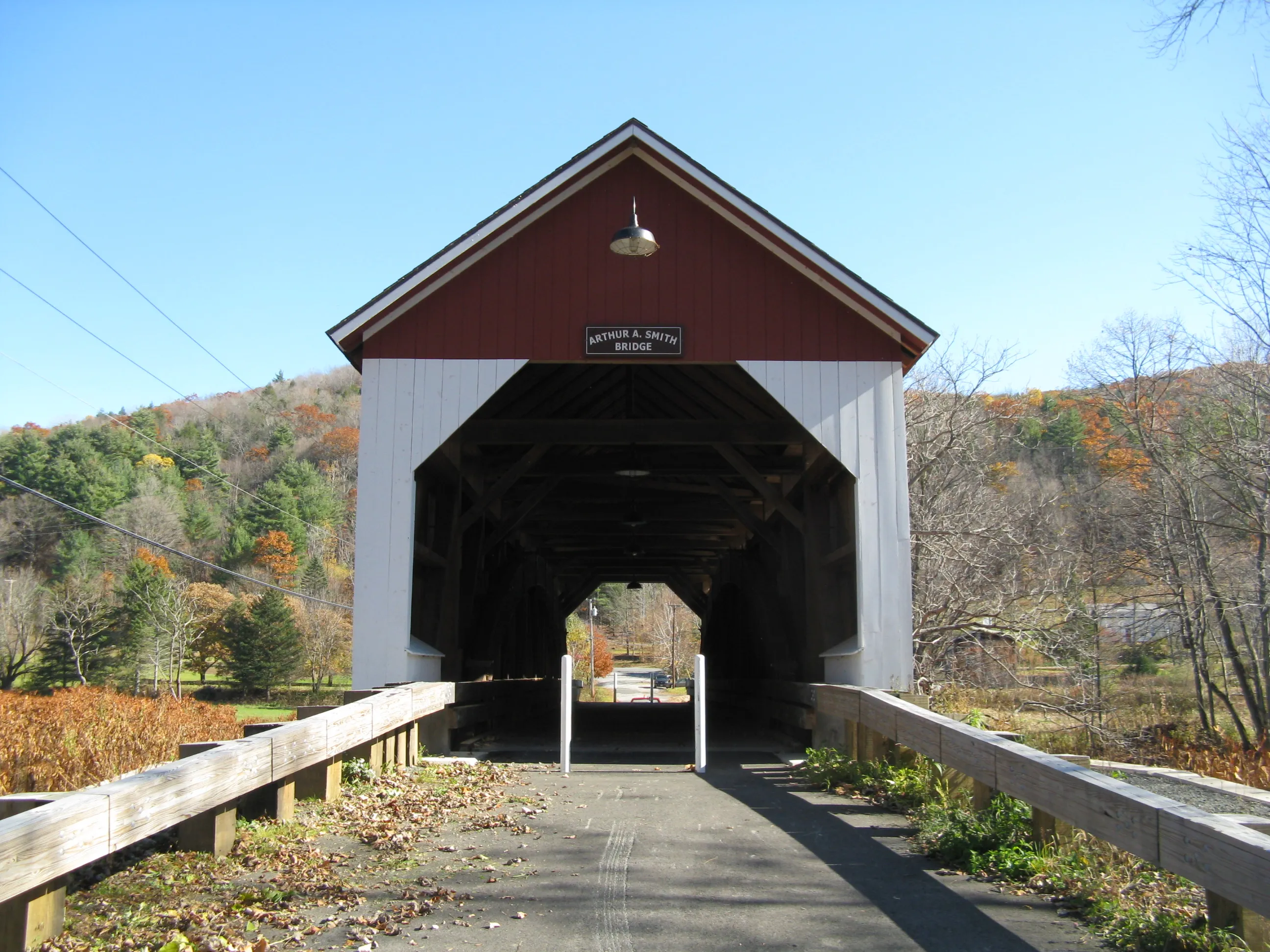
Arthur A. Smith Covered Bridge
The hero image looks east through the Arthur A. Smith Covered Bridge, a 100-foot single-lane Burr-truss covered bridge that carries Lyonsville Road over the North River west of Colrain Center. It was originally built in 1869 at a different crossing nearby and was moved to its present site in 1896 after the first location was damaged by flooding; it took its name from Arthur A. Smith, a prominent local resident at the new site. The bridge was added to the National Register of Historic Places in 1983, taken out of service in 1982, dismantled and rebuilt as part of a roughly $2.1 million reconstruction in 2007, and reopened to vehicle traffic in 2021. It is one of the few surviving 19th-century covered bridges in Massachusetts and one of just two Burr-truss spans in the state.
Catamount State Forest
Tucked into the highlands of southwest Colrain around the abandoned hilltop village of Catamount Hill is Catamount State Forest, a Massachusetts DCR property managed as a satellite of Mohawk Trail State Forest. Much of its acreage was acquired by the Commonwealth in 1967 after the village was abandoned in the early 20th century, leaving cellar holes and stone walls in the woods. The forest carries informal hiking and snowmobile routes; McLeod Pond is a small quiet pond used for fishing and canoeing. There are no developed visitor facilities. The main access is from Catamount Hill Road, with longer back-road approaches from Charlemont and Heath.
The 1812 schoolhouse flag
In May 1812, according to a long-standing local tradition documented by the Massachusetts Historical Society, the schoolhouse in Colrain’s hilltop Catamount village became the first public schoolhouse in the United States to fly the U.S. flag. The original schoolhouse is gone (Catamount village itself was abandoned in the early 20th century), and similar “first school flag” claims surface elsewhere, so the story is best read as part of Colrain’s civic memory rather than a settled historical fact. A small schoolhouse monument marks the site in what is now Catamount State Forest.
Other notes
- Colrain has a long agricultural history and is one of the major apple-growing towns in Franklin County; Pine Hill Orchards on Greenfield Road and several smaller cider and farm operations are open seasonally.
- The historic village center, Colrain City (the town’s half-jokingly named center along Main Road in the valley below Chandler Hill), was listed as the Colrain Center Historic District on the National Register in 2006 and has remained largely unchanged for about 150 years.
- The town’s nine recognized historic village clusters (Elm Grove, Lyonsville, Foundry Village, Shattuckville, Griswoldville, Colrain City, Catamount Hill, Stewartville, and Gimletville) reflect the small mill-and-farm scale of the 19th-century town.
- The nearest interstate access is via Bernardston on I-91 to the east, or Greenfield about nine miles southeast at the I-91/Route 2 interchange.
Colrain has no traffic light, no through-state-highway commercial strip, and no large village center. It is one of the quietest hill towns in Franklin County, with most of its activity spread across the small mill villages along the North River and its tributaries between Heath and Greenfield.
Sources
- Town of Colrain
- Colrain, Massachusetts — Wikipedia (2020 U.S. Census population: 1,606; settled 1735; incorporated June 30, 1761)
- Arthur A. Smith Covered Bridge — Wikipedia
- Catamount, Massachusetts — Wikipedia
- Massachusetts Historical Society — “The First Flag Over a Schoolhouse?”