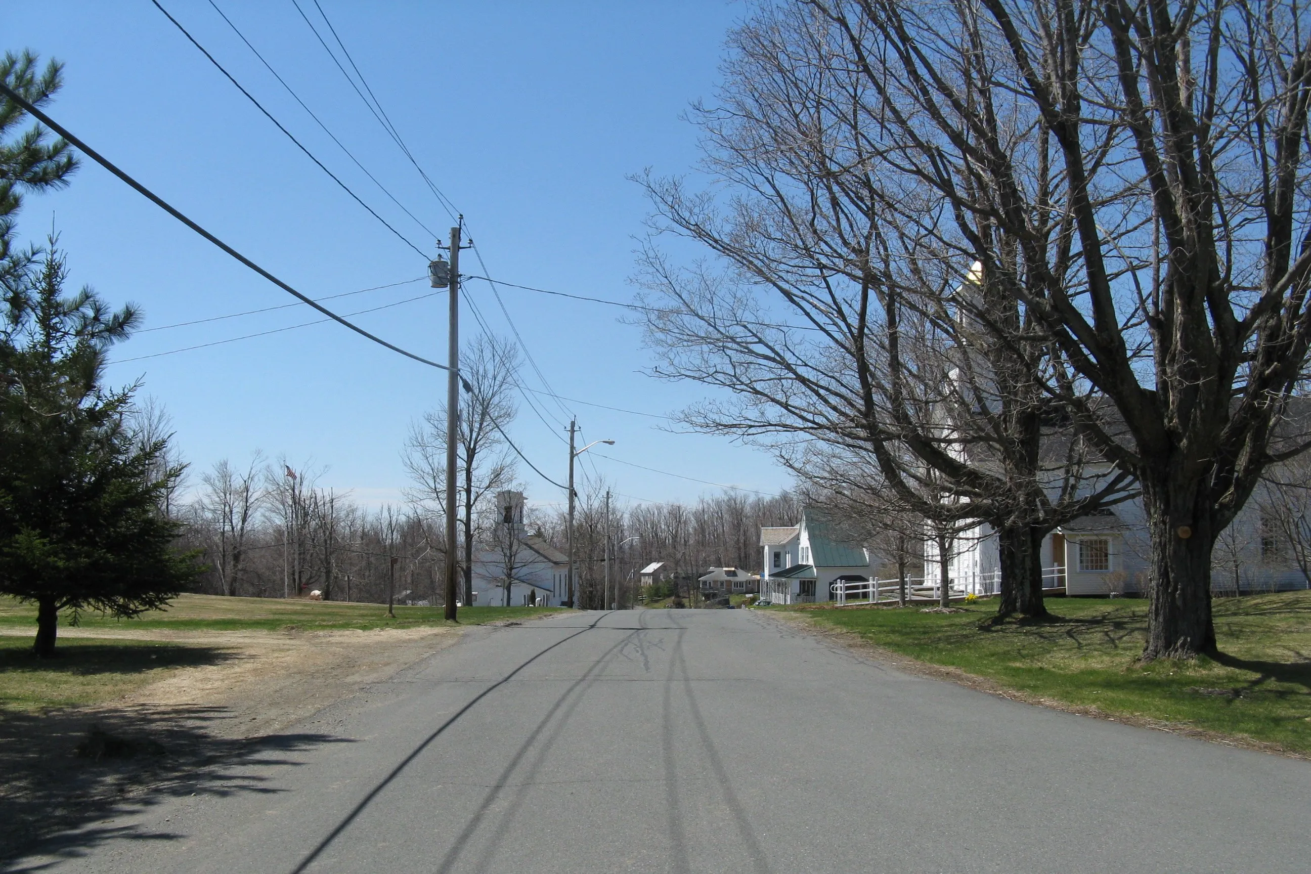
Heath is a small Franklin County hill town of about 700, set on a high upland plateau in the far northwest corner of the Pioneer Valley region, sharing its northern boundary with Vermont. The town was set off from Charlemont and incorporated on February 14, 1785. It is bounded by Whitingham and Halifax, Vermont to the north; Charlemont to the south; Colrain to the east; and Rowe to the west. The village common and most of the surviving 18th- and 19th-century civic fabric (the Heath Union Church, the Heath Memorial Hall, the town offices, and a handful of houses) sit at roughly 1,700 feet of elevation around the intersection that the hero image looks east along.
Heath Center
Heath Center is a small upland village clustered around the common at the top of the town. Most of the buildings face East Main Street and South Road and were assembled across the late 18th and 19th centuries; the district is listed on the National Register of Historic Places (the Heath Center Historic District, 2007). The two civic anchors are the Heath Union Church (a white-clapboard meetinghouse with Greek Revival pilasters, modest Gothic Revival window tracery, and a square belfry, designed by Col. David Snow and built in the 1830s) and Heath Memorial Hall, the small clapboard town hall on the common where annual town meeting is held.
The Heath Fair
The town’s best-known annual event is the Heath Fair, run by the Heath Agricultural Society at the Heath Fairgrounds two weekends before Labor Day. The fair has run since 1916 and is one of the smaller, more old-fashioned agricultural fairs in Western Massachusetts: ox and horse drawing, livestock exhibits and 4-H, vegetable and home-arts halls, woodsmen’s events, a midway, and a Sunday parade. The Heath Agricultural Society was incorporated as a nonprofit in 1969 to carry the fair forward.
Burnt Hill
In the southeast corner of town, Burnt Hill rises to roughly 1,800 feet, among the highest points in Heath. On its summit sits the Burnt Hill stone circle, a small ring of standing stones whose origin and date have been debated for decades: proponents read it as a pre-Columbian astronomical site, while academic archaeologists generally treat it as a colonial-era boundary marker or stone-clearing pile. Either reading aside, the ridge is a quiet upland walk, with long views back across the Deerfield River valley toward Charlemont and the Berkshires.
Reinhold Niebuhr and the Serenity Prayer
The American theologian Reinhold Niebuhr (1892–1971) kept a summer home in Heath for much of his career. He is generally credited with composing the original version of the Serenity Prayer here, and is said to have first delivered it from the pulpit of the Heath Union Church in 1934: a small footnote to the town’s quiet civic life that nonetheless travels the world many times over each year through 12-step recovery programs.
Other notes
- Heath sits high enough that its weather routinely runs colder and snowier than the river towns just below it; Route 8A climbs out of the Deerfield River valley at Charlemont and crosses the town on its way north into Vermont.
- The town has no traffic light, no supermarket, and no through-state-highway business strip; the village store and post office are at Heath Center.
Sources
- Town of Heath
- Heath, Massachusetts — Wikipedia (2020 U.S. Census population: 723; incorporated February 14, 1785)
- Heath Agricultural Society
- Heath Center Historic District — National Register #07001103