Charlemont is a small Franklin County hill town of about 1,200 in the Deerfield River valley at the western edge of the Pioneer Valley, where Route 2 (the Mohawk Trail) climbs out of the Connecticut Valley toward the Berkshires. The town was incorporated in 1765. It is bounded by Hawley to the south, Buckland to the southeast, Shelburne and Colrain to the east, Heath to the northeast, Rowe to the northwest, and Florida and Savoy across the Berkshire line to the west.
The Mohawk Trail
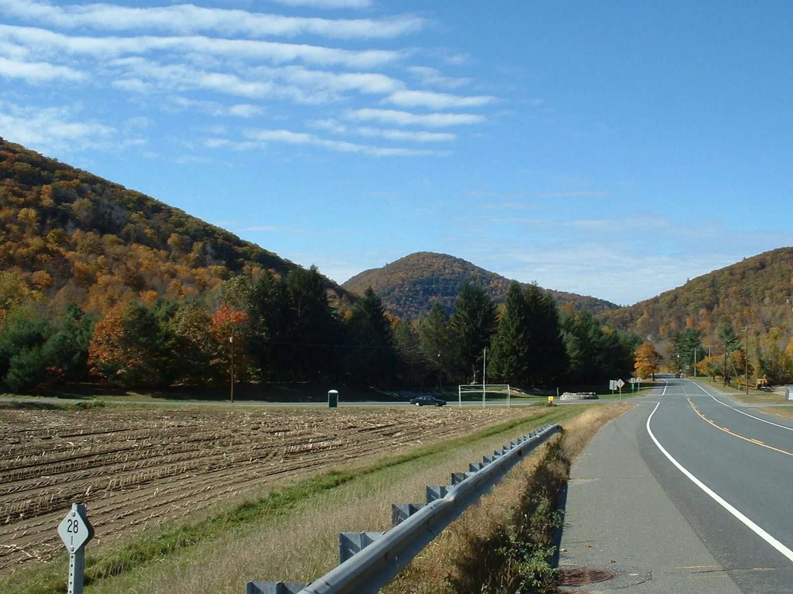
The hero image looks west up Route 2, the section of the state highway designated the Mohawk Trail between Greenfield and Williamstown. The road follows the Deerfield River through Charlemont and was opened as a scenic auto route in 1914, as one of the country’s earliest officially-designated tourist highways. Most of the town’s commercial fabric (the Charlemont Inn, the Curtis Country Store, the surviving handful of mid-20th-century roadside cabins and gift stands, and the restaurants and rafting outfitters) is strung along Route 2 on the south bank of the river through Charlemont Center.
Hail to the Sunrise
At Mohawk Park along Route 2 east of Charlemont Center stands the Hail to the Sunrise monument, a bronze statue of a Native warrior with arms uplifted, looking east across the Deerfield River. The 900-pound bronze was sculpted by Joseph Pollia and dedicated on October 1, 1932, paid for by the Improved Order of Red Men as a memorial to the Native peoples of the Mohawk Trail region. The base is set in a small reflecting pool ringed with about a hundred inscribed stones from Red Men councils across the country. The statue’s framing is a product of its 1930s fraternal-order origins; the actual Native communities of the Charlemont area (most directly the Pocumtuck to the east, with seasonal Mohawk presence farther west) are addressed in contemporary interpretive material from the regional descendant community and in Deerfield’s Pocumtuck-focused museums.
Bissell Covered Bridge
On Route 8A north of Charlemont Center, the Bissell Covered Bridge carries North Heath Road over Mill Brook. The current 92-foot span (a TECO Enhanced Long through truss) dates to 1951, a near-replica of an earlier covered bridge that dated to about 1881, rebuilt after the town objected to a proposed modern steel-and-concrete replacement. It was added to the National Register of Historic Places in 2004 and reopened to traffic after a 2008–2009 rehabilitation. It is one of just a handful of New England covered bridges still carrying full two-lane vehicular traffic.
Berkshire East and the Deerfield River
South of the river on Mt. Institute (about 1,540 ft, on the Charlemont–Hawley line) is Berkshire East Mountain Resort, a four-season operation that runs alpine skiing in winter and a mountain coaster, zip-line, and mountain-bike trails in summer. The Deerfield River below the mountain is a dam-controlled commercial whitewater run. Water released from the upstream Fife Brook Dam feeds several outfitters based in or just outside Charlemont (most prominently Zoar Outdoor in the village and Crab Apple Whitewater at Fife Brook), running both the Class II–III Fife Brook section through the Charlemont reach and the Class III–IV “Dryway” run upstream above the dam on its scheduled spring and fall release days.
Other notes
- The Mohawk Trail State Forest, a roughly 6,000-acre DCR property spanning Charlemont, Hawley, Savoy, and Florida, takes in most of the western half of Charlemont. Old-growth white-pine groves, the Indian Trail ridge walk, and the small Cold River drainage are all within it.
- The Charlemont Inn, on Route 2 in Charlemont Center, is traditionally dated to 1787 as a stagecoach stop and ran (with changes) for over two centuries before closing in 2011; as of recent years it has changed hands and faced ongoing efforts toward reopening.
- Tropical Storm Irene in August 2011 damaged Route 2 and several Deerfield River outbuildings in Charlemont; the highway was repaired and reopened later that year.
Sources
- Town of Charlemont
- Charlemont, Massachusetts — Wikipedia (2020 U.S. Census population: 1,185)
- Hail to the Sunrise — Wikipedia
- Bissell Bridge (Massachusetts) — Wikipedia