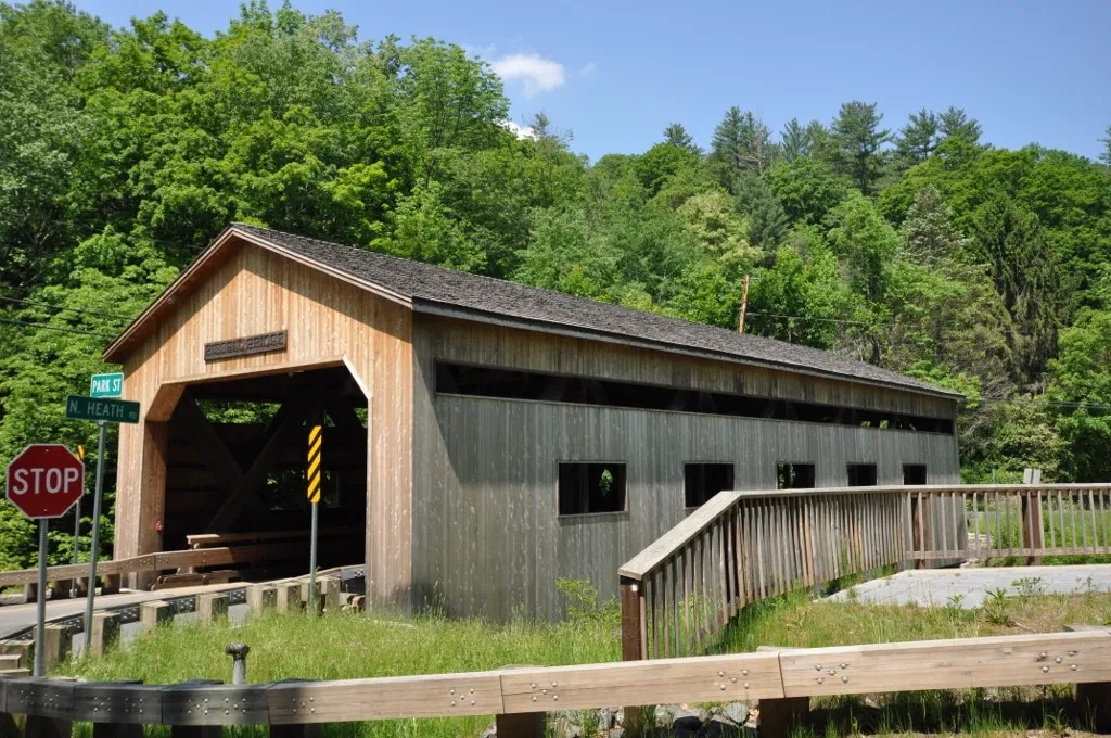
The Bissell Covered Bridge carries North Heath Road (Route 8A) over Mill Brook just north of Charlemont Center. The current 92-foot Long-truss span dates to 1951, a near-replica of an 1840 original, built after the town objected to a proposed modern steel-and-concrete replacement of the failing earlier bridge.
It was added to the National Register of Historic Places in 2004 and reopened to traffic after a 2008–2009 rehabilitation. It is one of just a handful of New England covered bridges still carrying full two-lane vehicular traffic, rather than reduced to single-lane, foot, or bicycle use.
What to see
- The portal and trusswork: a pedimented entry with a carved “Bissell Bridge” sign over the road, and the long timber Long-truss visible from inside the deck or from the brookside below.
- Mill Brook and the ravine: a short pull-off at the south end gives a side view of the bridge from above the water; in fall the surrounding hills color out.
- The walkway: a separated pedestrian walk runs along one side, so the bridge is comfortable to cross on foot even though traffic still uses it.
Visiting
The bridge sits on Route 8A about a mile north of Route 2 in Charlemont, easy to combine with a drive on the Mohawk Trail, a stop at Hail to the Sunrise, or a Deerfield River rafting trip out of the village. There is no formal parking lot; pull off on the road shoulder near the bridge approaches and walk in. The bridge is free and viewable at any hour.