Shelburne is a small Franklin County town of about 1,900 in the hill country between Greenfield and the Berkshires. It is shaped by two very different centers: a quiet upland village at Shelburne Center, where Route 2 (the Mohawk Trail) runs east–west through farmland on the ridge, and Shelburne Falls, the much-visited village along the Deerfield River, which Shelburne shares with Buckland across the water.
Shelburne Falls
Shelburne Falls is one of the most-photographed small villages in the state, and the chief reason most visitors come to Shelburne. The Deerfield River drops over a ledge of bedrock here and the village sits stacked up the riverbanks on both sides, Shelburne on the north (and east), Buckland on the south.
The two best-known features are right at the river:
- The Bridge of Flowers, a 400-foot, five-arched concrete trolley bridge built in 1908 by the Shelburne Falls & Colrain Street Railway. Trolley service ended in 1928, and the Shelburne Falls Women’s Club has been planting the bridge with perennials every spring since 1929. It reopened April 1, 2026 after repairs, then closed temporarily on April 27 for soil replacement and replanting; check the bridge site for the current gate status.
- The Glacial Potholes below the dam: fifty-plus rounded cylindrical hollows ground out of the riverbed by the action of pebbles spinning in eddies as the post-glacial Deerfield River cut its current channel. They range from a few inches across to almost forty feet; view them from the signed overlook areas and stay out of restricted riverbed zones.
Beyond the river, the village’s commercial fabric (Bridge Street, State Street, Deerfield Avenue) is a compact, walkable cluster of late-19th and early-20th-century brick and frame buildings, with bookstores, glassblowing studios, restaurants, and a small movie theater. The whole zone is the Shelburne Falls Historic District, listed on the National Register. The river-side outdoors entry covers the falls and the upstream paddling/fishing on the Deerfield in more detail.
Shelburne Center
Three miles up the hill from the falls, Shelburne Center sits on the ridge along Route 2. It’s a much smaller place: a small village green, a white-spired 1840 meetinghouse (the First Congregational Church, the building familiar from the Mohawk Trail postcards), the town hall, and a handful of houses and farms. The town’s working agricultural land (orchards, dairy farms, hayfields) runs out from here in all directions.
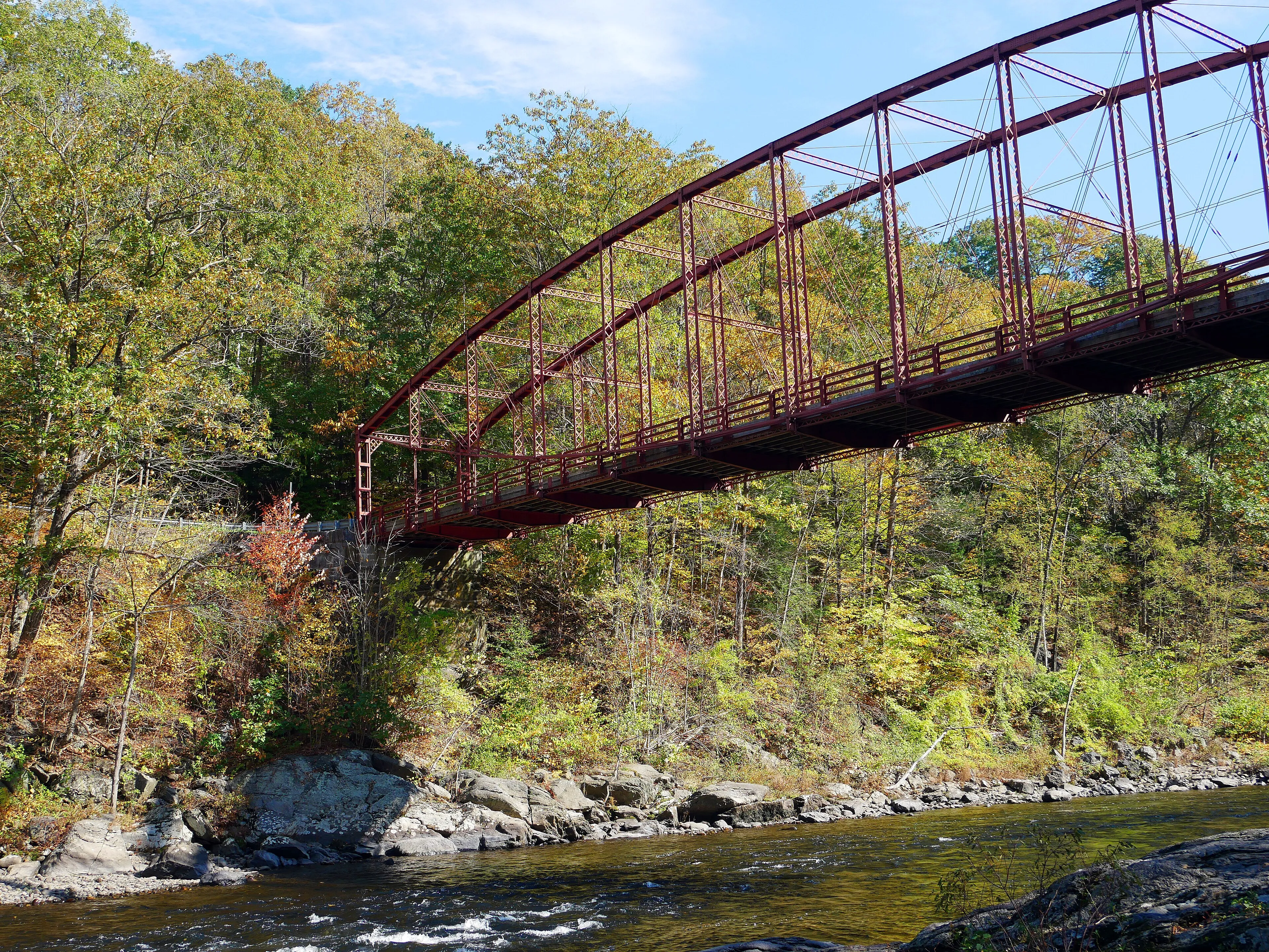
Bardwell’s Ferry Bridge
The hero image above is Bardwell’s Ferry Bridge (1882) over the Deerfield River on the Conway–Shelburne line, in the southeastern part of town. The bridge is a wrought-iron lenticular truss, an unusual, flattened “lens” form patented by William Douglas in 1878, and is one of the oldest and longest-surviving lenticular truss bridges in the country. It still carries one lane of road traffic on Bardwell’s Ferry Road; pedestrians can walk across.
The Mohawk Trail
The full length of Route 2 through Shelburne (from the Greenfield line in the east to the Buckland line at Shelburne Falls) is part of the Mohawk Trail, the 1914 scenic highway from Greenfield to North Adams. The drive is covered in detail in our fall-foliage Mohawk Trail guide.
Sources
- Town of Shelburne
- Shelburne, Massachusetts — Wikipedia (2020 U.S. Census population: 1,884)
- Shelburne Falls — Mohawk Trail Association
- Bridge of Flowers — official site
- Bridge of Flowers news and events