The Mohawk Trail (Route 2 from Greenfield west to the New York state line) is one of the oldest scenic highways in the country, designated in 1914. The stretch from Greenfield to the Berkshires is the part that earns the name most years, and peak color usually lands in the first two weeks of October. A half-day loop works well: west out of Greenfield on Route 2, north on Route 112, and back south along the river.
Start in Greenfield
Begin on Greenfield’s common and drive west on Route 2. Within fifteen minutes you’re climbing into hill-town forest. (For the French King Bridge view, take a brief detour east first along Route 2 to the bridge over the Connecticut River at the Gill–Erving line; the long steel cantilever-arch carries the road 135 feet above the water and is worth the short stop before doubling back through Greenfield to begin the westbound drive.)
Shelburne Falls
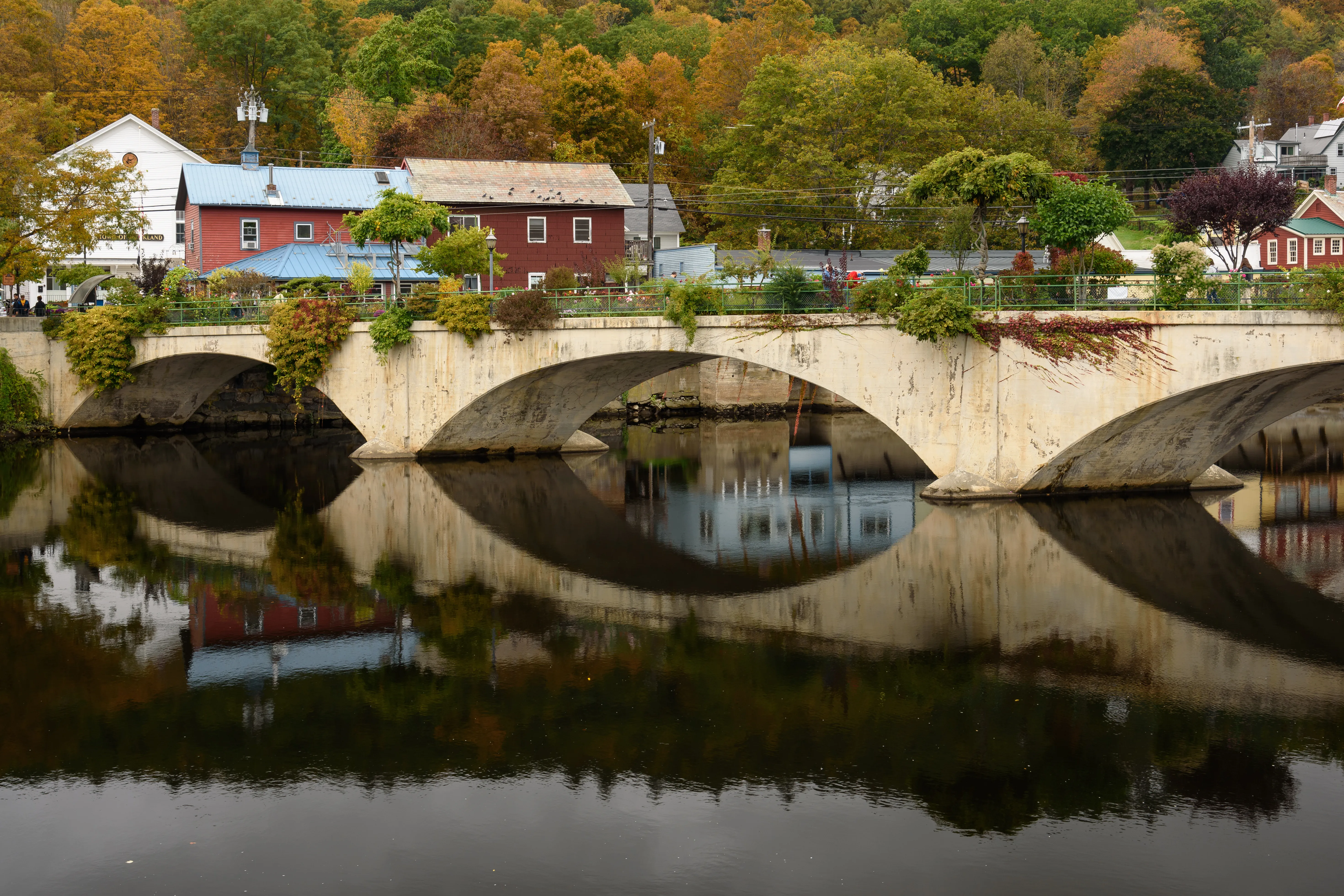
About twenty minutes west, turn off for Shelburne Falls. The village sits at the Deerfield River and is best known for the Bridge of Flowers (a former trolley bridge replanted as a pedestrian garden since 1929) and the adjacent glacial potholes in the riverbed. Park once and walk the bridge, the Iron Bridge, and the storefronts on Bridge Street. For 2026, check the Bridge of Flowers’ current gate status before treating the garden span as part of the stop.
The hairpin and back
Continue west to Whitcomb Summit for the long foliage view, or turn around at the famous Mohawk Trail hairpin if you’d rather keep it short. On the way back, a southerly detour via Route 112 through Ashfield and Conway puts you back into Franklin County through rolling farmland, with one last ridge climb at Mount Sugarloaf for the valley overlook before sunset.
If you want more
- Swap Sugarloaf for a visit to Historic Deerfield on the way home.
- Add a stop at the Montague Bookmill for coffee and used books.
- Extend west into North Adams for Mass MoCA if you have a full day.
The Mohawk Trail Association publishes a peak-color map each September; check it the week you’re planning to go, and allow extra driving time on fall weekends, when the road fills up.