New Salem is a small Franklin County hill town of just under 1,000, sitting on the high ground above the western arm of the Quabbin Reservoir. The town was first settled in 1737 by families from Salem, Massachusetts, and incorporated in 1753. Its modern boundaries are shaped by the reservoir below. Orange and Athol lie to the north and northeast, Petersham to the east, Ware and Belchertown to the south across the water, and Pelham, Shutesbury, and Wendell to the west.
The New Salem Common
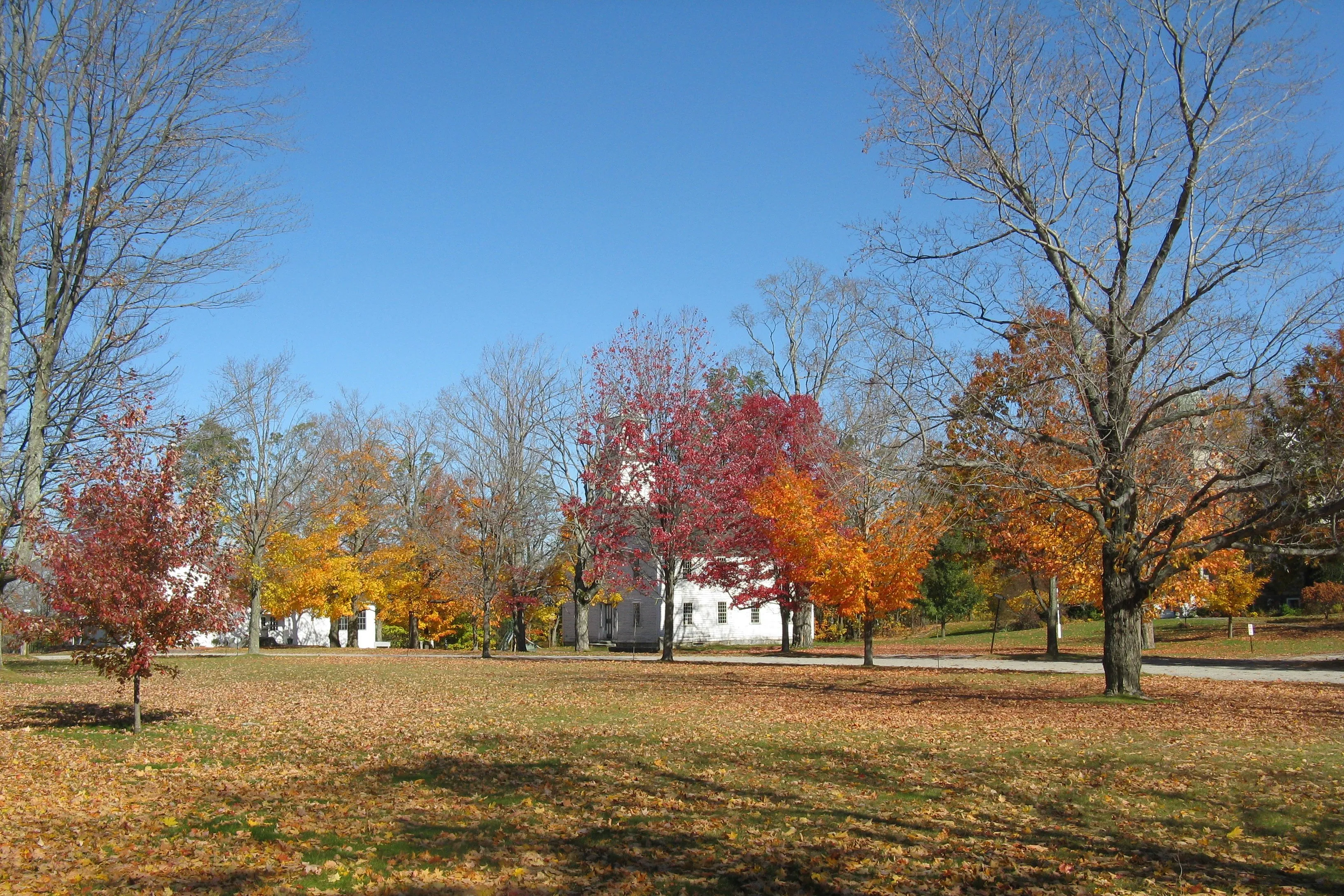
The hero image looks across the New Salem Town Common, the heart of the New Salem Common Historic District, which was listed on the National Register of Historic Places in 1978. The district covers about 35 acres along South Main Street with roughly 40 contributing buildings, including the First Congregational Church (1794), an 1838 town hall, and a small cluster of New Salem Academy buildings dating to the early 19th century. The white-clapboard Greek Revival academy building visible across the green in the photograph is one of these. The academy operated as a private school for much of the 19th century and remains in non-school community use.
The Quabbin Reservoir and the lost towns
The Quabbin’s creation in the 1930s reshaped New Salem’s geography in a way that runs counter to the usual Quabbin-displacement story. The four towns disincorporated in April 1938 to make way for the reservoir (Dana, Enfield, Greenwich, and Prescott) were drowned and their populations dispersed. New Salem itself was not flooded, but its southern town line was redrawn along the former West and Middle Branches of the Swift River, which now lie under the water. Above the new shoreline, New Salem annexed most of the former town of Prescott plus parts of Greenwich and Enfield, because the high ground between the reservoir’s two arms (the long peninsula now used for Quabbin Park access roads, fire lanes, and gates) was only reachable by land through New Salem. The town came out of the project larger on paper than it had been before.
The Swift River Valley Historical Society
The Swift River Valley Historical Society keeps a small museum compound in New Salem dedicated to the four lost towns. The complex grew over decades by relocating threatened buildings from the disincorporated towns up onto safe ground in New Salem, most notably the North Prescott Methodist Episcopal Church, which moved first to Orange in 1949 and then to its current New Salem site in 1985. The society’s collections include domestic objects, photographs, business records, and cemetery documentation from Dana, Enfield, Greenwich, and Prescott, and its members run a long-standing annual bus tour of the otherwise closed reservoir peninsula.
Bear’s Den
In the southwest part of town, Bear’s Den is a 6-acre Trustees of Reservations property on the Middle Branch of the Swift River, just upstream from where the branch enters the Quabbin. The Middle Branch drops about 12 feet into a small pool at the bottom of a narrow rock gorge whose walls rise roughly 70 feet above the water. The site was a colonial-era mill seat (a stone foundation from the mill is still visible beside the falls) and is reached by a short quarter-mile trail from a small roadside lot off Neilson Road.
Other notes
- New Salem Academy, founded in 1795 as one of the early Massachusetts academies, operated on the common for over a century; the surviving academy buildings now hold community uses rather than school functions.
- The Rabbit Run Rail Bed is a short hiking-and-biking trail on the former Athol & Enfield Railroad grade through New Salem, with a Quabbin overlook from the rail bed near the town’s southern end.
- Most of southern and eastern New Salem is Department of Conservation and Recreation watershed-protection land closed to general motor-vehicle use, which is why the town’s resident population has stayed small even as its acreage grew after 1938.