Pelham is a small Hampshire County hill town of about 1,300 in the upland country east of Amherst, on the western rim of the Quabbin Reservoir watershed. It was settled in 1738 by mostly Presbyterian Scotch-Irish immigrants and incorporated as a town in 1743. Pelham is bounded by Shutesbury to the north, New Salem and the Quabbin Reservation to the east, Belchertown to the south, and Amherst to the west.
The Old Town Hall
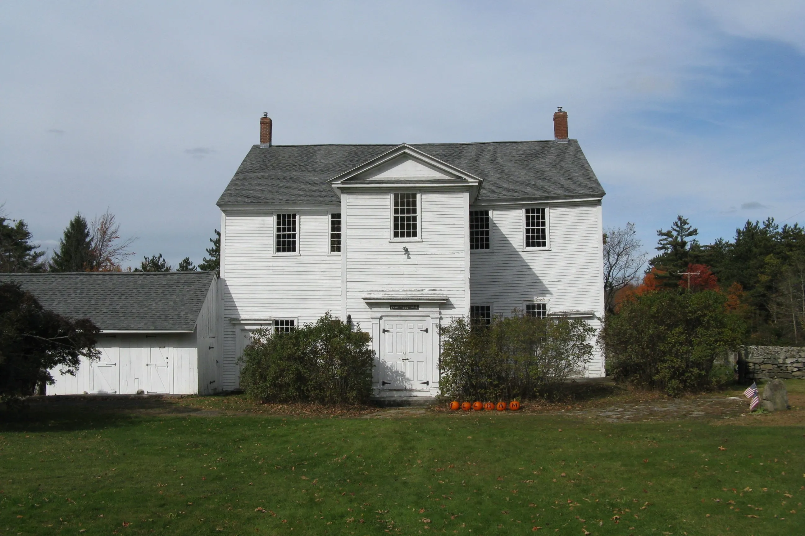
The hero image is the Old Pelham Town Hall at the four-corners village of Pelham Hill, on Route 202 (the Daniel Shays Highway). The building was put up in 1743 as the town’s first meeting house and served as both church and civic gathering space until Massachusetts disestablished the Congregational church in 1833. After the religious function ended, the town reworked the interior. The building was moved a short distance in 1839, then moved again and divided into two floors in 1845, and has been used for town meetings continuously ever since. The town claims it as the oldest town hall in continuous use in the United States, and Annual Town Meeting is still held in the upstairs hall every spring. The Old Town Hall and the adjoining 1839 brick church, 1840s common, and Cherry Hill Cemetery make up the Pelham Town Hall Historic District, listed on the National Register in 1971.
Daniel Shays and the rebellion
Pelham’s most famous resident was Daniel Shays (c. 1747–1825), a Revolutionary War captain who farmed in the eastern part of town in the 1780s. In the fall of 1786 and into the winter of 1786–1787, Shays and a circle of indebted Massachusetts farmers met at Conkey’s Tavern in Pelham, a Conkey-family roadhouse on the road that ran east through the Swift River valley, to plan the closing of the courts and what became known as Shays’ Rebellion. The rebellion was put down by a privately-funded state militia under Benjamin Lincoln after a January 1787 confrontation at the Springfield Armory and a final rout at Petersham in early February. Shays himself fled to Vermont and was eventually pardoned; he died in upstate New York in 1825.
The physical traces of Shays in Pelham are mostly gone. Conkey’s Tavern was in the part of town later taken for the Quabbin Reservoir in the 1930s, and its site is now submerged. The state highway through town, U.S. Route 202, is signed the Daniel Shays Highway, and his name attaches to a number of local landmarks, but the actual farm site is in the watershed and not publicly accessible.
The Quabbin and the eastern boundary
In the 1930s, the Massachusetts legislature authorized the building of the Quabbin Reservoir to supply drinking water to metropolitan Boston, and the eastern third of Pelham was taken by the Metropolitan District Water Supply Commission for the reservoir and its protective watershed. Pelham was not one of the four “drowned towns” disincorporated for the project (those were Dana, Enfield, Greenwich, and Prescott, all to the east), but a substantial part of its eastern land, including most of the West Branch of the Swift River and the Conkey’s Tavern site, ended up either underwater or inside the watershed reservation. The modern eastern boundary of Pelham follows the watershed line.
Today
Pelham today is a quiet residential hill town with no village-scale commercial center. The population concentrates along Route 202 and the network of east–west cross-roads (Amherst Road, Packardville Road, North Valley Road) that descend toward Amherst. Buffam Falls Conservation Area in the southwest corner of town has a short trail to a pair of small waterfalls on Buffam Brook and is one of the more accessible bits of public land. Pelham Lake and the various ponds along the watershed line are on protected MWRA land and are not open for general recreation.
Sources
- Town of Pelham
- Pelham, Massachusetts — Wikipedia (2020 U.S. Census population: 1,280)
- Pelham Town Hall Historic District — Wikipedia
- Shays’ Rebellion — Wikipedia
- Quabbin Reservoir — Wikipedia