Belchertown is a town of about 15,000 on the eastern edge of Hampshire County, between Amherst to the west and the Quabbin watershed to the east. Settled in 1731 and incorporated in 1761 as Belcher’s Town (named for Jonathan Belcher, the colonial governor who held the original land grant), it sits on the long ridge that runs between the Connecticut and Swift River valleys, with the Quabbin Reservoir filling the basin to the east.
The common and the town center
The center of Belchertown is a long, narrow town common along Route 9, one of the longer commons in the Valley, lined with mature trees and bracketed at the south end by the Stone House Museum and at the north by the Clapp Memorial Library.
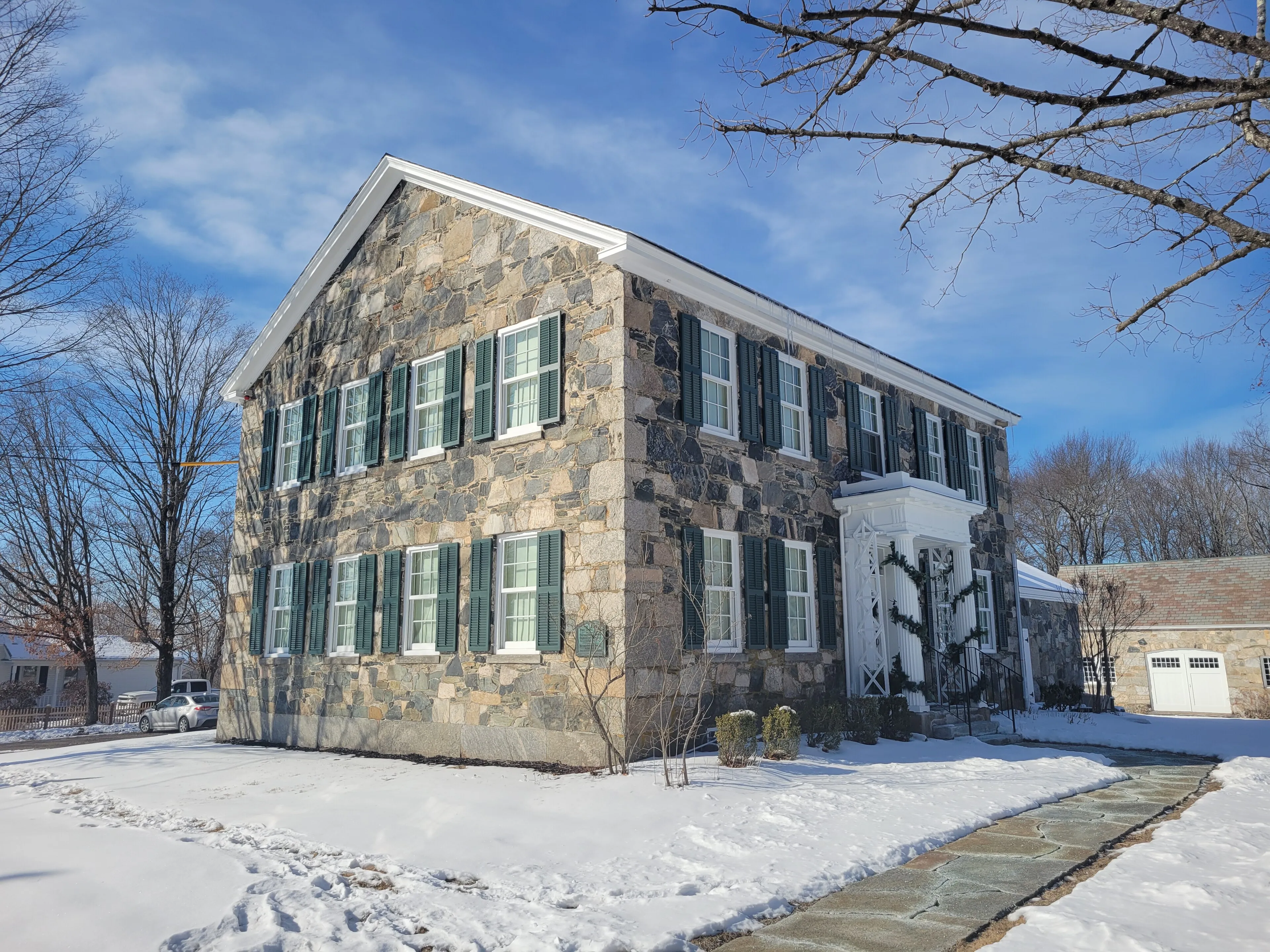
The Stone House Museum (pictured above) is the home of the Belchertown Historical Association, occupying an 1827 fieldstone house on the south common. It holds a small but dense collection of local history: early-19th-century furniture and domestic objects, archives related to the carriage industry that made the town’s name in the 1800s, and a separate carriage barn filled with restored Belchertown-built coaches and wagons. Open seasonally; small admission.
The Clapp Memorial Library at the north end of the common is a red-brick Romanesque Revival building from 1887, a gift to the town from a local benefactor; it remains the town library.
The carriage years
In the 19th century Belchertown was a meaningful node in the American carriage trade. Several local manufacturers built coaches, buggies, and farm wagons in shops scattered around the town center, shipping them out via the Central Massachusetts Railroad that ran through town until 1980. At its peak in the 1880s the trade gave Belchertown a brief national reputation. The Stone House Museum’s carriage collection is the best surviving record of that era.
The Belchertown State School
A more difficult chapter: from 1922 to 1992, Belchertown was the site of the Belchertown State School, a state institution for people with intellectual disabilities. The school became the subject of a landmark federal civil-rights lawsuit (Ricci v. Okin, 1972) over its conditions, and was eventually closed under a consent decree. The 800-acre site on the south side of town has been gradually redeveloped (including the 385-acre Lampson Brook Farm under state agricultural preservation), but the closure and its aftermath are still live subjects in town civic life.
The Quabbin Reservoir
The eastern third of Belchertown sits inside the Quabbin Reservoir watershed. The publicly accessible part, Quabbin Park (with the Winsor Dam, the Enfield Lookout, and Quabbin Hill), is reached by Route 9 about three miles east of the town common; the visitor center is on the dam’s east abutment. Most of the rest of the watershed is closed to general access, but Belchertown holds several gated walking entries (the gate-numbered access points DCR uses across the watershed) along Route 202.
Other notes
- The Belchertown Fair, held in September on the south common, is a long-running town agricultural fair, with three days of free entertainment, livestock and produce judging, and a Sunday parade. Free to walk in.
- Lake Wallace behind the police and recreation buildings on State Street has a short accessible Sensory Trail loop (paved, with braille signage and a cable guide), maintained by the town Recreation Department, the DPW, and a volunteer Friends of Lake Wallace group.
Sources
- Town of Belchertown
- Belchertown, Massachusetts — Wikipedia (2020 U.S. Census population: 15,350)