Monson is a Hampden County hill town of about 8,150 in the uplands south of Palmer, set in the rolling country between the Quaboag and Chicopee drainages where Hampden County meets the Connecticut state line. The town was set off from Brimfield and incorporated as a separate town on August 23, 1775, with its first town meeting held three months after the battles of Lexington and Concord. Main Street (Route 32) runs north–south through the village center, the spine on which most of the town’s history has played out.
The June 2011 tornado
On the late afternoon of June 1, 2011, a single long-track EF3 tornado crossed the Pioneer Valley from west to east. It touched down in Westfield at 4:17 p.m., crossed West Springfield, the South End of Springfield, and Wilbraham, and tore directly through the center of Monson before continuing on into Brimfield, Sturbridge, Southbridge, and Charlton. The storm’s 37-mile path was the longest of any tornado in Massachusetts in modern record. In Monson the tornado damaged 238 buildings, 77 of them destroyed beyond repair, knocked down the steeple of the First Church of Monson at the head of Main Street, took off the roof of the old high school, and flattened or stripped a swath of houses on the south side of the village. There were no direct deaths in town; an elderly resident who had sheltered in her basement during the storm died of her injuries the following morning.
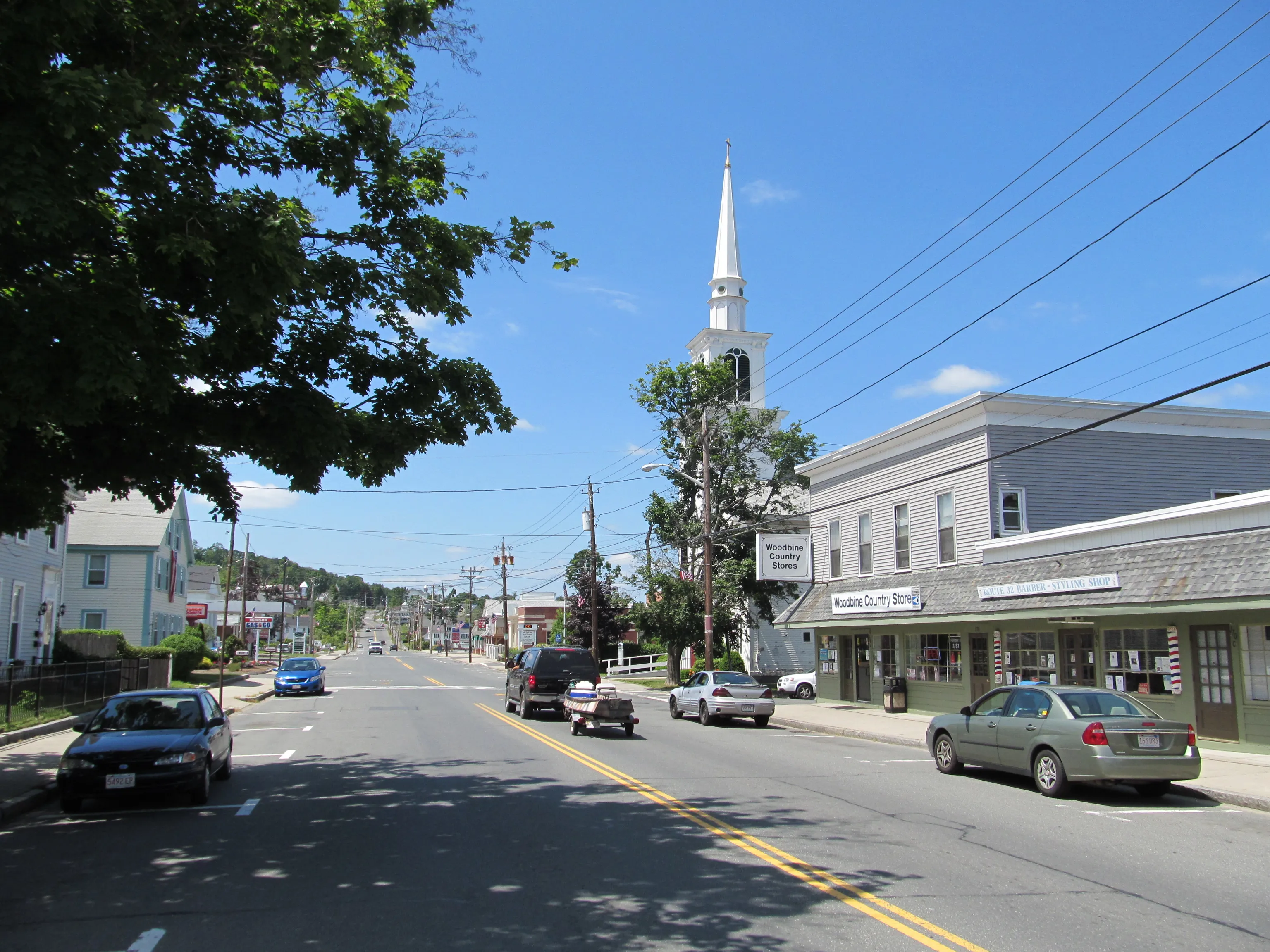
The town spent most of the next several years rebuilding. The First Church’s replacement steeple, a near-replica of the 1939 original, went up in October 2013. The hero image, taken in June 2012, looks south down Main Street about a year after the storm, past the Monson Methodist Church on the right (its spire had been replaced in 2010, the year before the tornado, and survived the storm).
The granite quarries
Monson sits on a band of gray-to-pinkish biotite granite that runs through the uplands east of the Connecticut Valley, and from the early 19th century into the 1930s the town was a notable granite-quarrying center. The first commercial pit opened in 1809; the dominant operator from the mid-19th century onward was Rufus Flynt and, after him, the W. N. Flynt Granite Company, which by 1900 employed close to 500 workers. Monson granite was used in foundations and trim across the Northeast, and a railroad spur, the short Granite Branch, was built east from the Boston & Albany line at Palmer to haul finished blocks out. The industry collapsed in the 1930s in the general post-Depression decline of dimension stone; the spur was abandoned, and the trail along its old right-of-way is still walkable in places.
Monson Academy
Monson Academy, founded in 1804 and opened in 1806, was for most of the 19th century one of the better-known preparatory schools in central Massachusetts. It is unusual in American educational history for having enrolled Chinese students from 1847, a small group sent out under the auspices of the early China-mission movement, several decades ahead of any other American school. Its alumni include the abolitionist and women’s-rights advocate Lucy Stone and the U.S. Supreme Court justices William Strong and Henry Billings Brown. In 1971 the academy merged with the Wesleyan (Wilbraham) Academy in Wilbraham to form Wilbraham & Monson Academy, which has operated on the Wilbraham campus ever since. The original Monson Academy buildings on Main Street still stand and now serve as the Monson town offices and library.
Peaked Mountain Reservation
In the southwest corner of town, the Trustees of Reservations’ Peaked Mountain Reservation preserves about 425 acres on and around Peaked Mountain (1,227 feet), with another roughly 600 acres of associated parcels in town under various conservation ownership, close to a thousand acres protected in total. The property was assembled around 1999 through a partnership of the Trustees, the town, and the Norcross Wildlife Foundation in neighboring Wales. The summit ledges give long views east and north, including Mount Wachusett, the southern Berkshires, and on a clear day the Vermont Greens. The reservation’s network of fire roads loops past Lunden Pond in the Miller Forest tract and a small mid-19th-century hunting cabin. The trailhead is on Butler Road; admission is free, sunrise to sunset.
Other notes
- The Quaboag River, which drains the central-Massachusetts uplands west toward the Chicopee, forms part of Monson’s northern boundary with Palmer.
- Conant Brook Dam, a U.S. Army Corps of Engineers flood-control structure on the south branch of Conant Brook in the western part of town, was completed in 1966 and is the smallest of the Corps’ reservoirs in the Connecticut River basin; it is normally dry, with the impoundment area held as passive open space.
- Monson is bounded by Palmer to the north, Brimfield and Wales to the east, Stafford, Connecticut to the south, and Hampden and Wilbraham to the west.