Granville is a Hampden County hill town of about 1,500 in the southwest corner of the Pioneer Valley, on the Connecticut state line west of Southwick and south of Westfield. It was incorporated in 1754 out of land first granted as Bedford Plantation (an early name for the area set off from Westfield). The town has three village centers strung roughly east–west along Route 57: Granville Center (the main village, with the meetinghouse and town offices), West Granville (a small early-19th-century hamlet farther up the hill), and Granville Corners at the eastern end near the Southwick line.
The Country Store and Granville cheddar
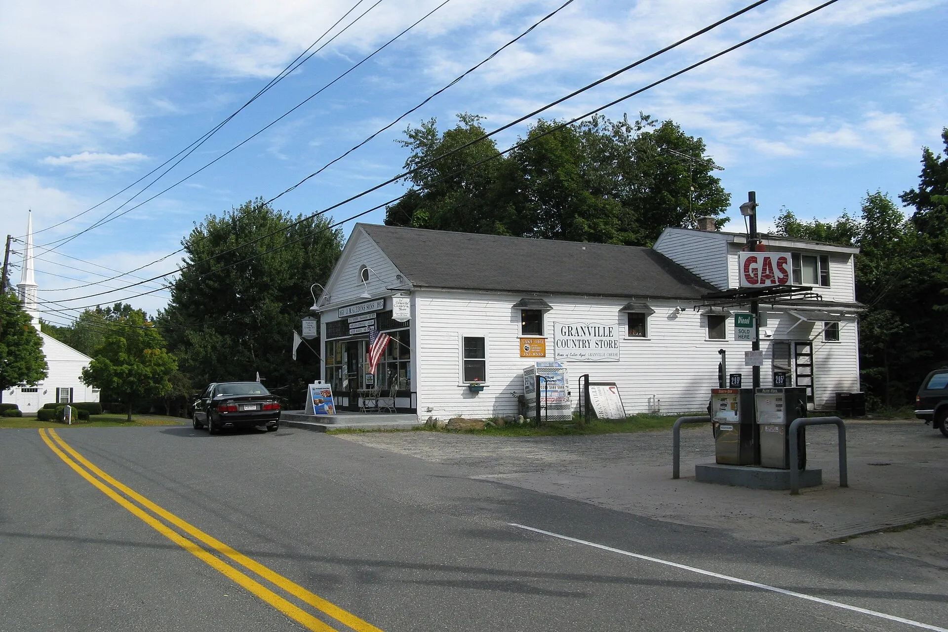
The hero image shows the Granville Country Store, the long white-clapboard general store and gas stop in Granville Center that is the town’s most familiar landmark. The store is best known for Granville cheddar, a sharp, cellar-aged cheddar with a long local tradition tied to the town’s 19th-century dairy farms. The exact lineage of the cheese (which farms made it, when, and where it is aged today) is the subject of folk-history retellings that don’t always agree, so we will leave the specifics to a wheel and a knife at the counter rather than try to pin them down here.
Noble & Cooley
The town’s other long-running enterprise is Noble & Cooley, a drum-shell manufacturer founded in 1854 and still operating in Granville under a descendant of the Cooley family. It is among the oldest drum companies in the United States, and possibly the oldest still in continuous operation. The original product was a small wooden toy drum; the modern shop builds professional snare drums and drum kits sold to working musicians around the world. The factory complex sits on Water Street near Granville Center.
Granville State Forest
The town’s open-space anchor is Granville State Forest, a roughly 2,400-acre DCR property that straddles the Granville–Tolland line in the southern Berkshire foothills. The forest’s signature feature is the Hubbard River gorge, where the river drops about 450 feet over 2.5 miles through a series of pools and ledge waterfalls. The forest has a campground, swimming holes along the Hubbard, and a network of woods roads and trails; it is one of the quieter DCR forests in western Massachusetts and rarely crowded outside of summer weekends.
Watershed town
Granville’s hills are an unusually important piece of regional water supply. The town sits across the headwaters of streams feeding three major reservoirs: the Cobble Mountain Reservoir (Springfield’s main water source), the Westfield system, and Connecticut’s Barkhamsted Reservoir, which supplies the Hartford metropolitan district. A great deal of Granville is therefore protected watershed land (undeveloped, lightly roaded forest), and the town’s small population reflects, in part, the constraints those land protections place on development.
Other notes
- The town is bordered by Southwick on the east, Westfield on the northeast, the hill towns of Russell and Blandford on the north, Tolland on the west, and the Connecticut towns of Granby and Hartland on the south.
- The Old Meeting House at Granville Center, a white-clapboard Federal-era meetinghouse, anchors the village green and is a frequent setting for the town’s summer events.
- The Granville Village Historic District, the Old Center Historic District, and the West Granville Historic District are all listed on the National Register of Historic Places: three separate small districts, one for each of the town’s village centers.
Sources
- Town of Granville
- Granville, Massachusetts — Wikipedia (2020 U.S. Census population: 1,538)
- Granville State Forest — Wikipedia
- Granville State Forest — Mass.gov
- Noble & Cooley — Wikipedia