Southwick is a Hampden County town of about 9,200 in the southwest corner of the Pioneer Valley, immediately south of Westfield and west of Agawam. It is the southernmost town in western Massachusetts, the only Massachusetts town that sticks south of the otherwise-straight MA–CT state line, in a rectangular projection known as the Southwick Jog. The town was set off from Westfield and incorporated as a separate district on November 7, 1770.
The Southwick Jog
The Jog is a roughly two-square-mile rectangular salient of Massachusetts territory that pokes south into Connecticut, between the Connecticut towns of Granby (east) and Suffield (west). It is the result of a long boundary fight that began in 1642, when Massachusetts hired surveyors Nathaniel Woodward and Solomon Saffery to lay out the line, and they put the western end about eight miles too far south. Connecticut later argued the boundary back north, and after compromises that gave Connecticut the towns of Suffield, Enfield, Somers, and Woodstock (originally settled from Massachusetts), the two states finally settled the western portion in 1804. The 1804 compromise split a disputed 2.5-square-mile parcel around the Congamond Lakes: Massachusetts kept the western five-eighths, Connecticut took the eastern three-eighths, and the resulting irregular boundary is the Jog as it stands today.
The “stake” (the actual surveyor’s marker at the southwest corner of the Jog, where the line bends north again) sits on East Street in Granby, Connecticut. It is a small concrete monument, but for boundary-trivia visitors it is the spot that defines the most famous bit of squiggle on the Massachusetts map.
Congamond Lakes
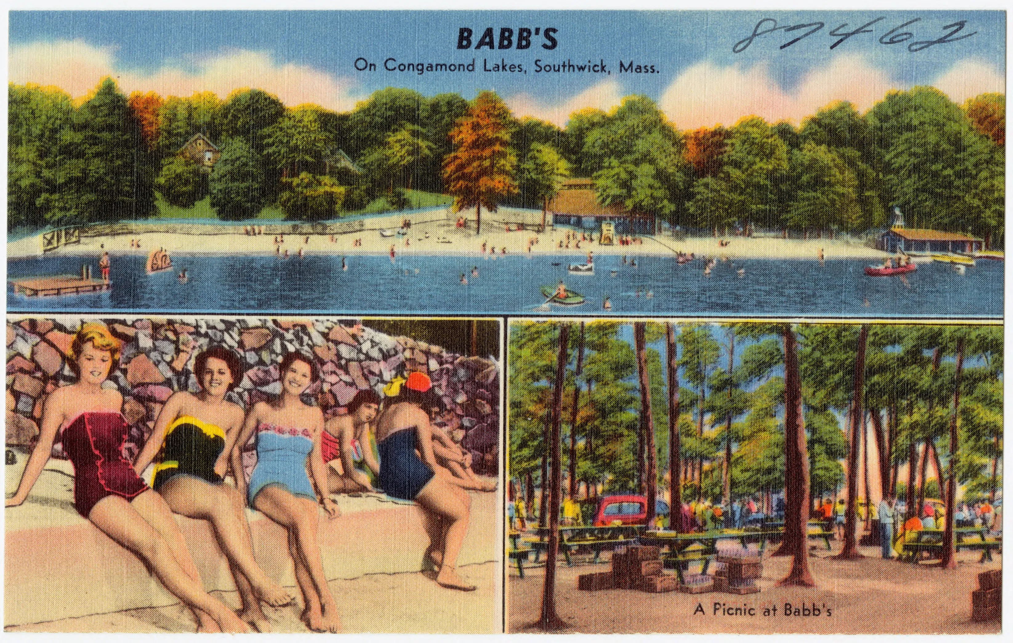
The town’s signature landscape is the Congamond Lakes, three connected glacial ponds (North Pond, Middle Pond, and South Pond) strung roughly north-to-south along the eastern edge of the Jog and partly into Suffield, Connecticut. The lakes were known to the Algonquian peoples as Wenekeiamaug.
Through the late 19th and early 20th centuries Congamond was a working summer-resort district along the trolley line out from Springfield: rooming houses and dance halls along the shore, ice harvested off the ponds in winter and shipped by rail down to New York and Boston, and day-trippers in summer. Babb’s (in the hero image) was one of the lakeside pavilions of that era; the Babb’s Roller Skating Rink, descended from the same operation, is one of the few survivors. Today the lakes are a public boating, fishing, and ice-fishing destination, with a state boat ramp on Middle Pond and a town beach.
Farms and the Pro Motocross
Southwick is still a working agricultural town. The broad gently rolling terrain west of the Connecticut River valley supports dairy, orchard, and tobacco farms, and the town has resisted the suburban density of nearby Westfield and Agawam. Route 57 runs east–west across the town and is the main commercial spine; the village center sits at its intersection with Route 10/202.
The town’s other modern claim to fame is The Wick 338, the motocross track on Powder Mill Road, which has hosted the Southwick National round of the AMA Pro Motocross Championship for most of the series’s history. The race weekend, in early July, brings tens of thousands of spectators into a town an order of magnitude larger than its usual population.
Other notes
- The town is bounded by Westfield on the north, Agawam on the east, the hill town of Granville on the west, and the Connecticut towns of Suffield and Granby on the south.
- The town’s name comes from Southwick, Hampshire in southern England, the home village of the Moore family who were among the early Westfield settlers of the area.
- Provin Mountain, the low traprock ridge that rises along the Agawam–Southwick line, is the town’s eastern horizon and carries a stretch of the Metacomet–Monadnock Trail along its crest.
Sources
- Town of Southwick
- Southwick, Massachusetts — Wikipedia (2020 U.S. Census population: 9,232)
- Southwick Jog — Wikipedia
- The Southwick Jog — Connecticut State Library
- The Wick 338