Agawam is a Hampden County city of about 28,700 on the west bank of the Connecticut River, directly across from Springfield. The two main village centers are Agawam Center, on the river-bottom flats nearest the bridge, and Feeding Hills, the older agricultural settlement on the higher ground to the west. The name Agawam is from the Algonquian, variously interpreted as “unloading place” or “fish-curing place.” The Westfield River meets the Connecticut here, and the seasonal anadromous fish runs were a major reason the spot was settled.
A long history of separation
Agawam’s modern boundaries are the result of a long sequence of splits from Springfield. The land was part of William Pynchon’s 1636 purchase that founded Springfield; the west-bank parish was set off as the Second Parish of Springfield in 1696 and incorporated as the separate town of West Springfield in 1774; the southern portion of West Springfield split off as the new town of Agawam in 1855; and Agawam adopted a city-form charter in 1972 (effective 1973), though the legal name remains “Town of Agawam.” The string of separations is unusual in Massachusetts; most towns separated once and stayed separate, not three times across two centuries.
Captain Charles Leonard House
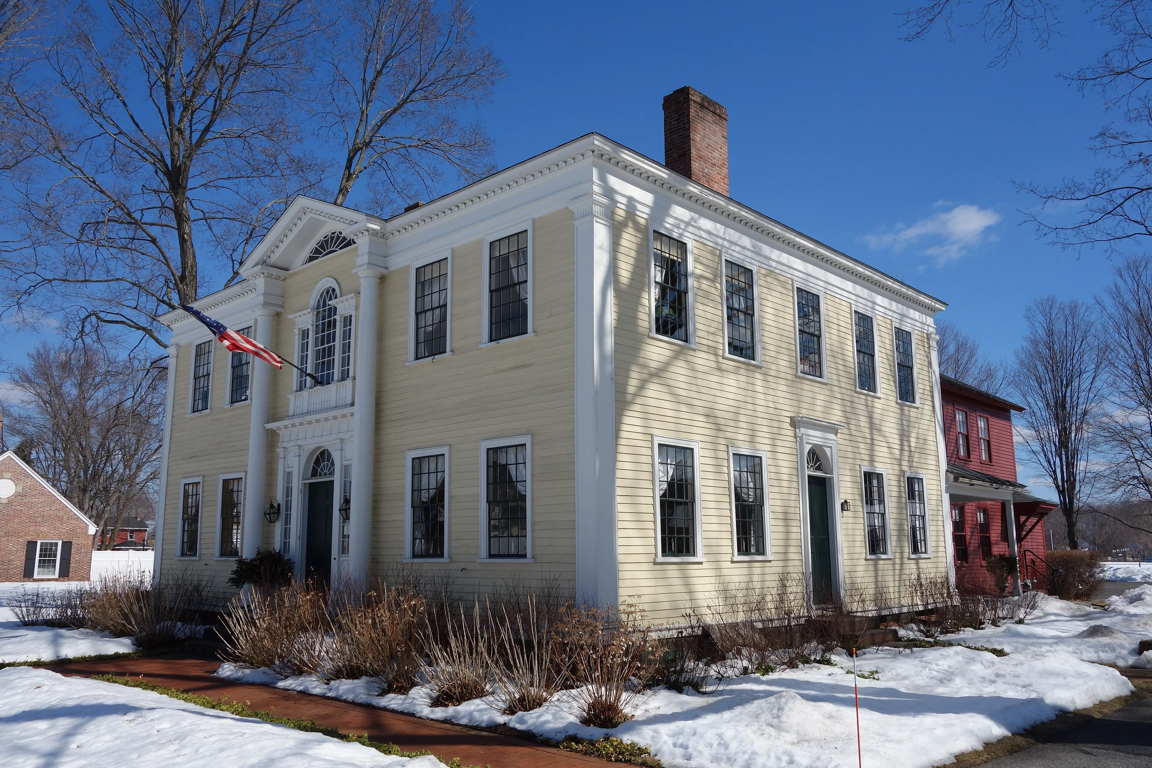
The hero image above is the Captain Charles Leonard House at 663 Main Street in Agawam Center, built in 1805 and attributed to the New England architect Asher Benjamin, who also designed several Boston churches and authored some of the earliest American architectural pattern books. The house was originally Agawam’s fourth tavern, the first overnight stop on the Hartford-to-Boston stage line. It was added to the National Register of Historic Places in 1975 and now operates as a nonprofit event venue.
The building is the best surviving Federal-era structure in town: two stories, hipped roof, a deep entry portico with paired Doric columns supporting a Palladian window above the front door, and an elliptical fanlight in the gable end. Asher Benjamin’s idiom is visible in the precise classical proportions and the restrained ornament.
Six Flags New England
The town’s largest single attraction is Six Flags New England, on the river side of Agawam Center. The park is the oldest park in the Six Flags chain, with a continuous lineage running back to Gallup’s Grove in 1870: first a picnic grove, then Riverside Grove (1887), then Riverside Park for most of the 20th century (1912 to 1995), then Premier Parks’ Riverside: The Great Escape (1996–1999), and finally rebranded Six Flags New England in 2000. Most older Pioneer Valley residents still casually call it “Riverside.”
The park’s signature ride is Superman The Ride, a steel hypercoaster opened in 2000 (briefly renamed Bizarro from 2009 to 2016 and now back to its original theme). It is regularly ranked among the top steel coasters in the world. The park runs roughly April through October.
Robinson State Park
The town’s open-space anchor is Robinson State Park, an 800-acre DCR park along the north bank of the Westfield River, with woods, river-bottom trails, and more than 20 miles of paths. The main entrance is on North Street in Feeding Hills.
On the river
The Connecticut River frontage in Agawam Center has the River Walk, a paved path along the riverbank with views across to the Springfield skyline. Provin Mountain (640 feet) on the western edge of town is the highest point in Agawam, a low traprock ridge running north-south, with a few trail entry points off the local road network.
Sources
- Town/City of Agawam
- Agawam, Massachusetts — Wikipedia (2020 U.S. Census population: 28,692)
- Captain Charles Leonard House
- Six Flags New England