Knightville Dam is a US Army Corps of Engineers flood-control dam on the East Branch of the Westfield River in Huntington, completed in 1941. The reservoir behind it is normally dry (the basin only fills during big runoff events), and the land around it functions as a quiet recreation area with multi-use trails, picnic spots, and river access.
A dry reservoir
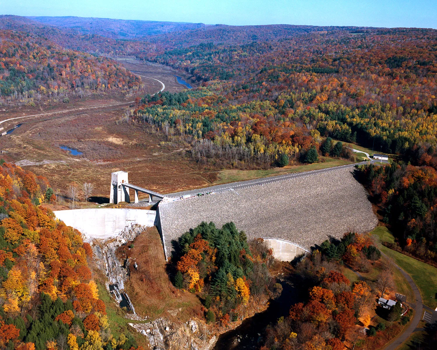
Knightville is what the Corps calls a dry reservoir: the basin only impounds water during heavy runoff, then releases it in a controlled way. The dam was built between 1939 and 1941 in response to the catastrophic 1936 flood on the Westfield and Connecticut Rivers. Most of the time the gates are open and the East Branch flows through more or less unobstructed; during large flood events the basin briefly backs up before water is metered back out downstream.
The result is an unusual kind of landscape: a wide, flat valley floor of meadows, gravel bars, and young hardwoods that gets periodically scoured and rearranged by floodwaters, with the river threading through the middle.
What to do
- Multi-use trails: several miles of dirt roads and trails wind through the basin and along the bluffs, used for walking, mountain biking, and horseback riding. Most of the network is flat and easy, on closed-to-traffic roadbeds.
- Picnic area: a Corps-managed picnic area with tables, fireplaces, drinking water, accessible restrooms, and a reservable shelter sits near the dam.
- Paddling: there is canoe and kayak access to the East Branch upstream of the dam; the river here is generally quiet and shallow outside of high-water events.
- Fishing: the East Branch holds wild and stocked trout; a Massachusetts freshwater license is required.
- The dam itself: the crest road gives a long view down the valley and back upstream into the basin, with the spillway visible below.
What to know
- Leashed dogs welcome on the trails and in the picnic area.
- The basin is huge and open: when the river is up, parts of the basin road and lower trails can be wet, muddy, or briefly flooded; the Corps closes affected areas during active flood operations.
- Wild and Scenic: the East Branch is part of the federally designated Westfield Wild and Scenic River system, which also covers Chesterfield Gorge upstream and the West and Middle branches.
- Spring runoff is the dramatic season here; the basin can fill briefly with a startling amount of water before draining back out.
- Hunting is permitted in season on much of the surrounding state-managed land; wear blaze orange in November.