Shutesbury is a small Franklin County hill town of about 1,700, set on a wooded upland between Lake Wyola in the northwest corner and the western edge of the Quabbin Reservoir watershed in the east. The town center sits on a ridge that rises to about 1,200 feet, putting Shutesbury among the higher village centers in the central Massachusetts uplands. It is bounded by Wendell to the north, Erving to the northwest, Leverett to the west, Pelham to the south, Amherst to the southwest, and New Salem to the east.
Roadtown and incorporation
The land was first laid out in 1735 as a proprietors’ plantation called Roadtown, named after a road that crossed it. The town was formally incorporated as Shutesbury in 1761, the new name honoring Samuel Shute, an early-eighteenth-century royal governor of the Province of Massachusetts Bay. The town never developed a major industry (there is no significant river, no mill village, and the soil is thin glacial till), and through the nineteenth century the population steadily declined as farms were abandoned. The 1880 population of 529 was less than a third of the 1840 figure. The current population (about 1,700) reflects a 20th-century rebound driven by Five College-area commuters and people drawn to the lake and the surrounding woods.
Lake Wyola
The town’s most-used outdoor destination is Lake Wyola (formerly Locks Pond), a roughly 130-acre lake in the northwestern corner of town with a public beach and small boat launch managed as Lake Wyola State Park (the Carroll A. Holmes Recreation Area) by the Massachusetts Department of Conservation and Recreation. The state park reach has the swimming beach, restrooms, picnic tables, and a paddle-craft launch; the rest of the lake is fringed by private camps and year-round houses. The Shutesbury Town Library, unusually, lends kayaks, paddles, and life jackets to library cardholders for use on the lake.
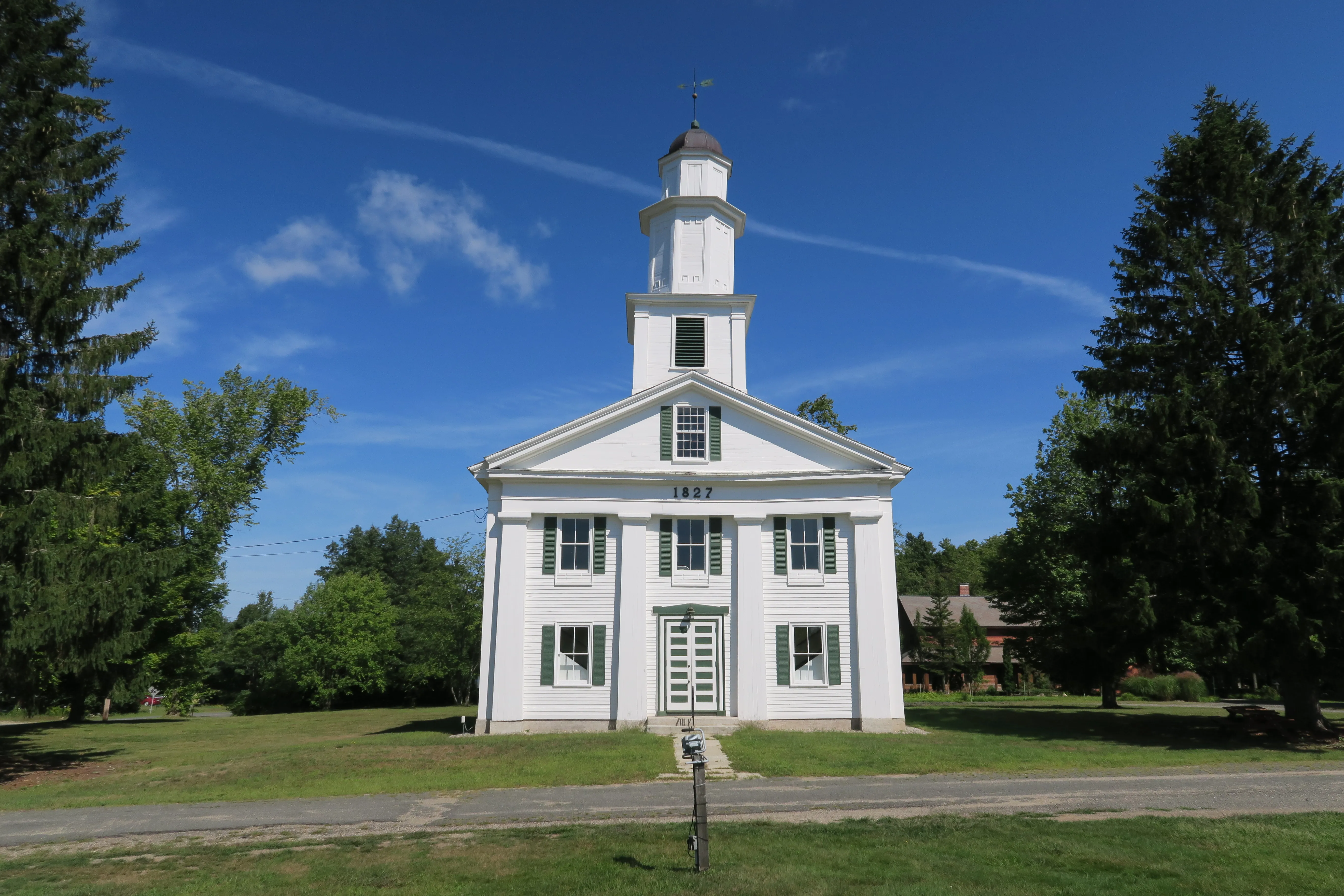
The 1827 meetinghouse
The hero image is the Shutesbury Community Church at the village center, a Greek Revival meetinghouse with the date 1827 carved into the pediment. The building is the visual center of the small village green and one of the few large nineteenth-century structures in town. The current Shutesbury Town Hall, a separate, much smaller, light-blue clapboard building nearby, is a more recent civic facility.
Forest and watershed
Most of Shutesbury is woods. The Shutesbury State Forest takes in a substantial part of the eastern half of town, and large private and conservation-held woodlots cover most of the rest. The brooks on the eastern side of the ridge drain to the West Branch of the Swift River and from there into the Quabbin Reservoir; the brooks on the western side of the ridge drain toward the Fort River and the Connecticut. The Quabbin boundary at the eastern edge of town is the closest the reservoir’s western branch comes to the Pioneer Valley line; there is no public access from the Shutesbury side.
Other notes
- Shutesbury and neighboring Leverett were profiled in a 2005 Boston Globe article as one of the country’s “broadband black holes,” a reflection of how rural and topographically broken the town is. State broadband-grant funding in 2017 under Governor Charlie Baker began closing that gap.
- The M. N. Spear Memorial Library in the village center is the smallest staffed public library in the state by some measures: a single-room building. The town has been raising funds for a replacement library for several years.
- Route 202 clips the eastern edge of town along the Quabbin-watershed boundary; otherwise Shutesbury is reached by back roads from Amherst, Leverett, or Erving.
Sources
- Town of Shutesbury
- Shutesbury, Massachusetts — Wikipedia (2020 U.S. Census population: 1,717)
- Lake Wyola State Park — Mass.gov
- M. N. Spear Memorial Library