Russell is a small Hampden County town of about 1,600 in the narrow Westfield River valley, where the river leaves the Berkshire foothills and turns east toward Westfield. The town was settled in the 1780s and incorporated in 1792. Two ridges close in on the river through Russell (Tekoa Mountain on the south side, the long wooded shoulders of the foothills on the north), so the town’s roads, railroad, and three small villages are all strung along the riverbank.
The villages
Russell is functionally three small village clusters along the Westfield River, set out from upstream to down:
- Crescent Mills sits at the upstream end of town, where the river enters from the north.
- Russell village is the administrative center, around the Town Offices and the Russell Community Church, on a flat shelf above the river. Main Street runs through here on its way to the river bridge.
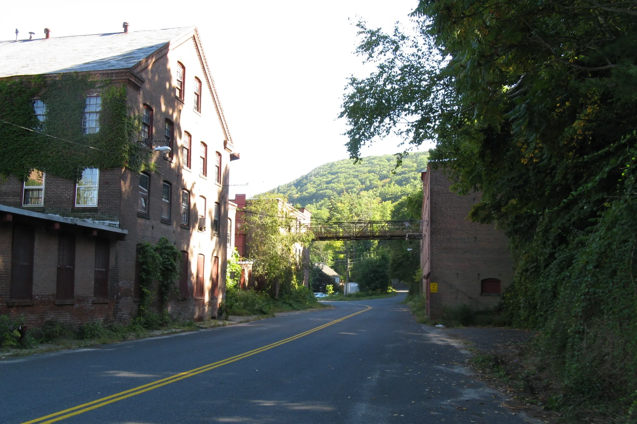
- Woronoco is the lower industrial village, on the south bank where the river bends east. The old Strathmore Paper complex still defines the village fabric: a cluster of brick mill buildings, an overhead skyway across the old road, and the village’s worker-housing rows climbing the hillside above.
The name Woronoco is from the Indigenous people whose name also gave colonial Westfield its early name; the same name is attached to the falls just below the village, once called Salmon Falls for the runs that came up to that point before the dams.
Strathmore Paper
For most of the 20th century Russell was a paper town. Horace A. Moses, an industrialist who had founded the Mittineague Paper Mill in West Springfield in 1892, bought the Woronoco Paper Company mill in Russell in 1904, and in 1914 merged the two operations into the Strathmore Paper Company, named for a Scottish valley he had visited in the 1890s. Strathmore became one of the country’s best-known producers of fine writing and drawing papers; the Woronoco mills ran under the Strathmore name through several later corporate owners (Hammermill from 1962, then International Paper) before paper-making at the Russell site ceased in 1999. The brick mill complex still stands along the river, its later years marked by partial demolition and intermittent redevelopment talk; the village itself remains tightly built around the mill walls.
Moses, an unusual figure for a 19th-century mill owner, used much of his Strathmore profits on philanthropy. He was a co-founder of Junior Achievement in 1919 and a major early funder of the 4-H and Boy Scout movements in western Massachusetts.
The Westfield River
The Westfield River through Russell is the mainstem, just below the confluence of the East, West, and Middle branches at the upstream town line. The river upstream of Russell (the East and West branches in the hills) was designated a federally Wild and Scenic River in 1993, the first such designation in Massachusetts; the Russell stretch itself is the more domesticated lower section, with old hydropower dams (built to serve the mills) and a still-active rail line on the south bank. Paddling, fishing, and a few informal swimming holes are the common river uses today.
Tekoa Mountain and outdoor land
The south side of the valley is dominated by Tekoa Mountain (elevation roughly 1,140 feet at the high point), a long trap-rock ridge whose south face holds steep cliff bands visible from US Route 20 along the river. The ridge has informal hiking access from Russell and from Westfield to the east, with broad valley views from the ledges. North of the village, the Noble View Outdoor Center (owned and run by the Appalachian Mountain Club) and the Moses Scout Reservation (named for Horace A. Moses) hold large tracts of forested ridge land open to public hikers.
Sources
- Town of Russell, Massachusetts
- Russell, Massachusetts — Wikipedia (2020 U.S. Census population: 1,643; incorporated 1792)
- Strathmore Paper Company — Wikipedia
- Horace A. Moses — Wikipedia
- Westfield River Wild & Scenic — National Park Service