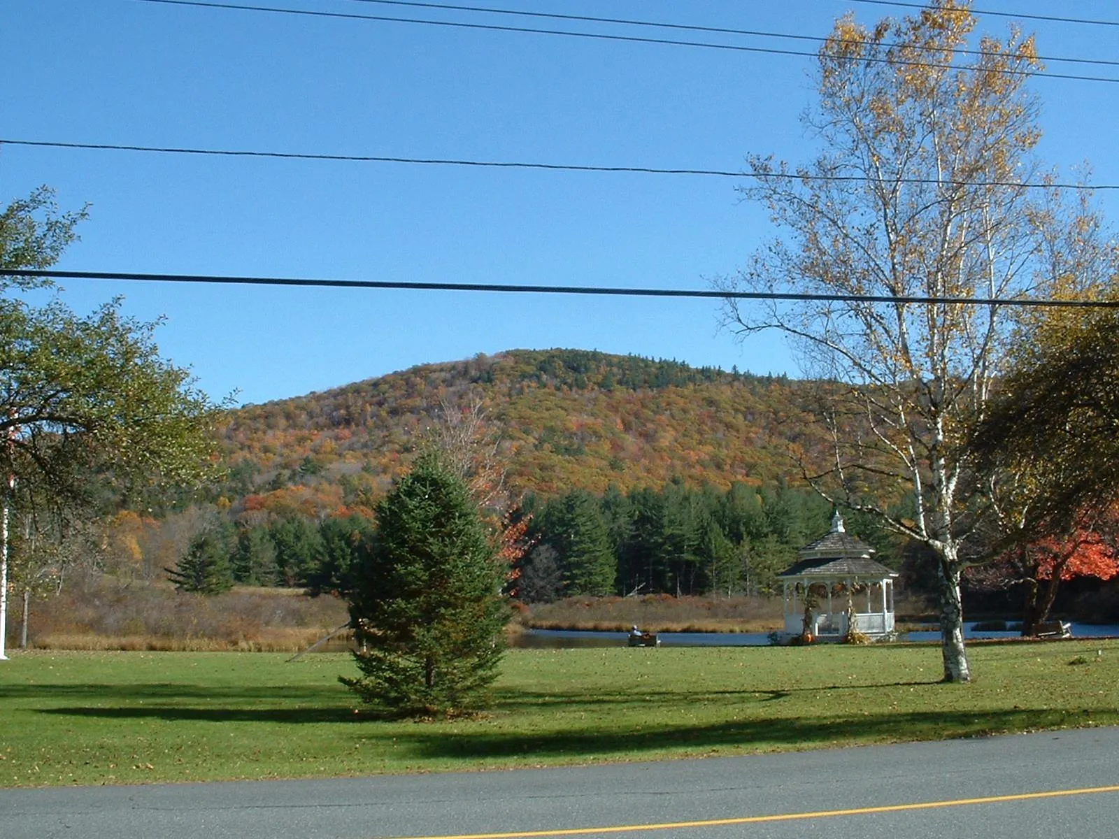
Rowe is a very small Franklin County hill town of about 400 in the far northwest corner of Massachusetts, sharing its northern boundary with Whitingham, Vermont. The town was settled in the 1760s and incorporated on February 9, 1785. It is bounded by Whitingham, Vermont to the north; Charlemont to the south; Heath to the east; and Monroe and Florida to the west, across the deep Deerfield River gorge. The town center sits at high elevation around the common, the Mill Pond, and Adams Mountain, the scene shown in the hero image.
Pelham Lake Park
The town’s centerpiece for outdoor recreation is Pelham Lake Park, a town-owned property of roughly 1,300 acres of forest surrounding the 81-acre Pelham Lake. The park has a town beach on the lake for Rowe residents, taxpayers, and signed-in guests, and a network of hiking, mountain-biking, snowshoe, and snowmobile trails that climb the surrounding ridges. The popular Pelham Lake Park Loop is a moderate roughly 7-mile hike around the lake and over the adjacent hills. The park is managed by the town, not by the state DCR, unusual for a property of this size in this part of the Pioneer Valley.
Yankee Rowe nuclear power station
From 1961 to 1991, the Yankee Rowe Nuclear Power Station operated on the Deerfield River at the western edge of town. A 180-megawatt pressurized water reactor, it was the first commercial nuclear power plant built in New England and the third in the United States. The plant was shut down in 1991 after concerns about embrittlement of its reactor pressure vessel, and the Nuclear Regulatory Commission declared decommissioning complete in August 2007. The site is now a closed spent-fuel storage facility on the river; it is not open to the public, and the surrounding land has largely returned to forest. The plant’s three-decade run is a significant chapter of Rowe’s 20th-century history and of New England energy history more broadly.
Davis Mine
In the eastern part of town, the Davis Mine is the abandoned site of what was once the largest iron pyrite mine in Massachusetts. The mine opened in 1882 and operated until a non-fatal collapse in 1911, by which point it had produced on the order of 100 tons of pyrite per day for sulfuric-acid manufacture and supported a small mining village of around 150 homes, a blacksmith shop, butcher shop, and electric lighting. By the late 1930s, only cellar holes remained. The site is now a classic ghost-town walk; it is also a long-running case study in acid mine drainage, with sulfide-laden water from the workings draining into Davis Mine Brook. The University of Massachusetts maintains a “Dynamic Digital Map” project documenting the mine’s geology and environmental legacy.
The town center and the Kemp-McCarthy Museum
Rowe Center is a small upland village around the town common, Mill Pond, and town offices on Zoar Road. The Rowe Historical Society runs the Kemp-McCarthy Memorial Museum at 282 Zoar Road, with rotating local-history exhibits drawn from the town’s agricultural, mining, and 20th-century industrial past. The unaffiliated Rowe Center retreat, founded in 1924 by the Unitarian Universalist Association, is also based in town and runs summer camps and adult conferences on the grounds of the former Rowe Conference Center campus.
Other notes
- Rowe is one of the smallest towns in Massachusetts by population; the 2020 U.S. Census count was 424.
- The town’s high point is Adams Mountain, the wooded ridge shown rising behind the common in the hero image.
- Rowe has no through state highway; access is via Zoar Road from Route 2 in Charlemont to the south, or via Tunnel Road from Florida along the Deerfield River.
Sources
- Town of Rowe
- Rowe, Massachusetts — Wikipedia (2020 U.S. Census population: 424; incorporated 1785)
- Yankee Rowe Nuclear Power Station — Wikipedia (operated 1961–1991; decommissioning declared complete August 2007)
- Pelham Lake Park — Town of Rowe
- Pelham Lake Park rules and regulations — Town of Rowe
- Davis Pyrite Mine, Rowe — UMass DDM project