Monroe is a tiny Franklin County hill town set in the steep Deerfield River gorge in the far northwest corner of Massachusetts. It is consistently among the smallest towns in the Commonwealth by population. The 2020 U.S. Census count was just 118. The town was incorporated in 1822 and named for President James Monroe, who was in office at the time. It is bounded by Stamford and Readsboro, Vermont to the north; Rowe to the east, across the Deerfield River; and Florida (in Berkshire County) to the south and west.
Monroe Bridge
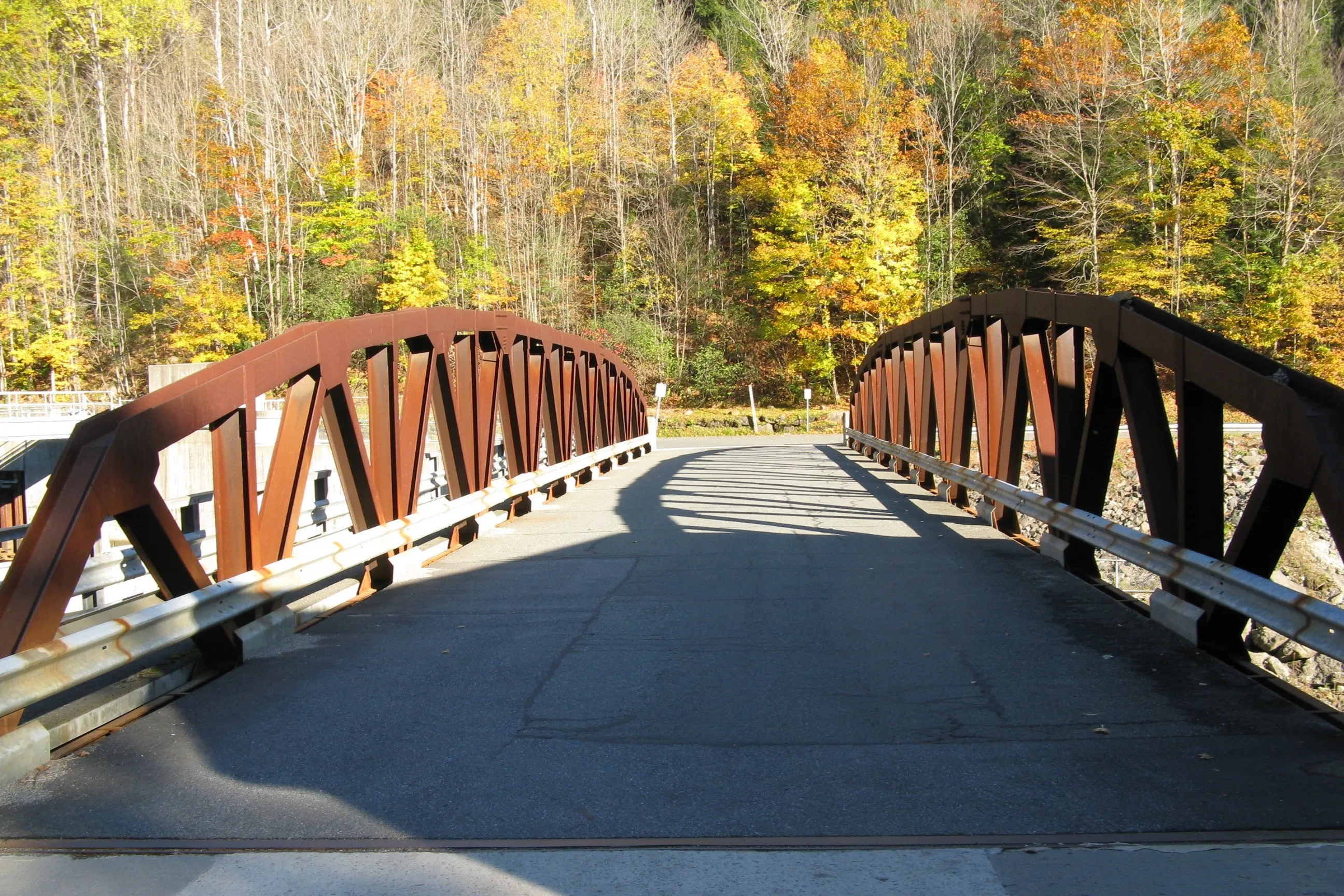
The town’s main settlement is the small mill village of Monroe Bridge, in the southeast corner of town where the Deerfield River runs along the Rowe line. The village grew up around late-19th- and early-20th-century paper- and pulp-mill work on the river; the small steel pony-truss highway bridge shown in the hero image carries the village’s main street across the Deerfield from Monroe into Rowe. Most of the town’s year-round houses, the town offices, and the volunteer fire department are clustered in and around Monroe Bridge.
Monroe State Forest
Most of Monroe outside the river-bottom village is taken up by Monroe State Forest, a roughly 3,750-acre DCR property that spans Monroe and the neighboring Berkshire town of Florida and reaches almost to the Vermont line. Its centerpiece is the Dunbar Brook trail, which follows the brook as it drops about 700 vertical feet over two miles of cascades, ledges, and pools on its way down to the Deerfield. The forest also includes the Raycroft Lookout, a stone overlook built by the Civilian Conservation Corps in the 1930s, with long views of the Hoosac Range, the Green Mountains across the Vermont line, and the Deerfield River gorge below, and a small but well-documented pocket of old-growth hemlock and red spruce on the steeper slopes.
The Deerfield River and the Dryway
The Deerfield River forms the eastern boundary of Monroe and threads down through the village of Monroe Bridge. The “Dryway” (the Class IV whitewater section between Fife Brook Dam upstream and Monroe Bridge village) runs along the Monroe–Rowe line. The Dryway is so called because, outside scheduled releases, most of the river’s flow is diverted through a tunnel to the Bear Swamp Pumped Storage powerhouse downstream, leaving the streambed nearly empty. On a handful of scheduled release weekends each year, typically in spring and fall, water is run through the Dryway and commercial outfitters based downstream in Charlemont run guided Class IV trips through the gorge.
Hoosac Tunnel
Just south of Monroe, in Florida, is the eastern portal of the Hoosac Tunnel, the 4.75-mile railroad bore through the Hoosac Range that was completed in 1875 after more than two decades of construction. The tunnel was, at its opening, the longest in North America, and the long construction project brought a brief boom of population and commerce to the Deerfield River villages below the eastern portal, including a small neighborhood in southwest Monroe associated with the project. The tunnel still carries freight rail today, and the eastern portal is visible from public roads in Florida along the Deerfield.
Other notes
- Monroe has no through state highway, no traffic light, and no village commercial strip; access from the south is via Tunnel Road and River Road along the Deerfield from Florida, and from the north via Tilda Hill Road and Main Road from Readsboro, Vermont.
- The town sits on the Hoosac Range, the northern end of the Berkshires, and most of its terrain is steep wooded hillside rather than the upland plateau common to nearby hill towns.
- The Deerfield River enters Massachusetts at the Monroe–Readsboro line and is the town’s eastern boundary along its full length.
Sources
- Monroe, Massachusetts — Wikipedia (2020 U.S. Census population: 118; incorporated 1822; named for President James Monroe)
- Monroe State Forest — Wikipedia (3,750 acres; Dunbar Brook; Raycroft Lookout)
- Monroe State Forest — Mass.gov / DCR
- Hoosac Tunnel — Wikipedia (25,081 ft / 4.75 mi; first train Feb 9, 1875)
- Deerfield River — Wikipedia (Dryway: Monroe Bridge to Bear Swamp, Class IV)