Hawley is a very small Franklin County hill town of about 350 people, set on the high upland between the Deerfield River valley and the Berkshire line. Originally settled around 1760 as Plantation Number 7 by people from Hatfield, the town was incorporated on February 7, 1792. It is bounded by Charlemont to the north, Buckland to the east, Ashfield to the southeast, Plainfield to the south, and Savoy to the west. The town covers nearly 31 square miles and has fewer than a dozen people per square mile, among the lowest population densities in Massachusetts.
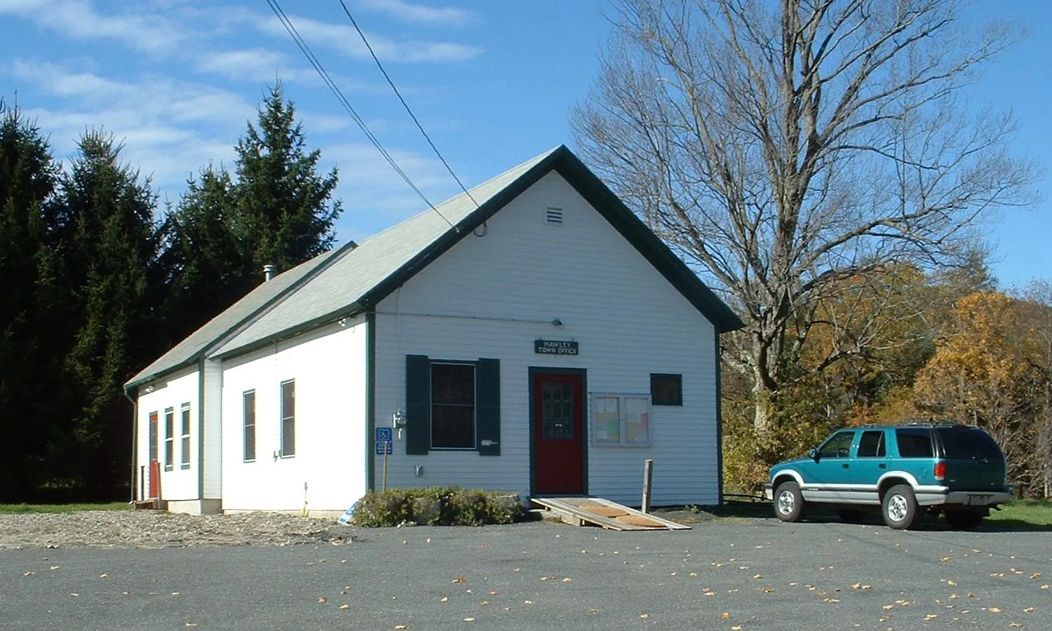
Hawley Town Hall and the old common
The hero image shows the Hawley Town Hall, a modest white-clapboard, gabled building that serves as the seat of the town’s open town meeting government. The town has no village center in the usual New England sense: no general store, no post office, no traffic signal. The historic Old Town Common sits on East Hawley Road in the eastern part of town, with a small cluster of 18th- and 19th-century buildings around it; current civic life centers on the town hall, the highway garage, and a handful of seasonal community events.
Hawley Bog
Just off East Hawley Road, near the Old Town Common, lies the Hawley Bog Preserve, a roughly 65-acre high-elevation sphagnum-peat bog, considered one of the best-preserved acidic kettle-hole bogs in Massachusetts. The peat mat is reported to be more than thirty feet thick in places, and the bog hosts the suite of plants typical of an undisturbed northern bog: sphagnum mosses, sundews, pitcher plants, leatherleaf, black spruce, and tamarack. The preserve is owned jointly by The Nature Conservancy and Five Colleges, Inc. (Smith, Mount Holyoke, Hampshire, Amherst, and UMass), and is used as a field-research site by area colleges. A short trail and boardwalk lead out into the bog mat from a small parking pull-off on Hawley Road.
Kenneth Dubuque Memorial State Forest
The largest piece of public land in town is the Kenneth Dubuque Memorial State Forest, a DCR property that spreads across Hawley, Plainfield, and Savoy. The forest contains about 35 miles of mixed-use trails open to hiking, mountain biking, horseback riding, cross-country skiing, and snowmobiling, plus a roughly one-mile interpretive loop around Hallockville Pond. Scattered through the woods are the cellar holes and stone walls of abandoned 19th-century farmsteads, and a surviving beehive charcoal kiln, a reminder of the period when these hills were largely cleared for charcoal-making and sheep pasture. The forest includes Parker Hill, the highest point in town.
Mohawk Trail State Forest (south end)
The southern, upland end of the Mohawk Trail State Forest reaches into the northwest corner of Hawley from Charlemont. The Charlemont side of the forest holds most of the visitor infrastructure (the campground, the picnic areas along the Cold River, and the Indian Trail ridge walk), but the Hawley side carries some of the quietest woods-roads and old-growth white-pine stands in the property.
Other notes
- Hawley is one of the smallest towns in Franklin County by population. It has no school of its own; school-age children attend district schools in neighboring towns.
- Stump Sprout, a small backcountry cross-country ski and lodge operation, sits in the woods between the Dubuque forest and the Mohawk Trail forest.
- A portion of Berkshire East Mountain Resort sits on the Charlemont–Hawley town line, on the south flank of Mt. Institute.
Sources
- Town of Hawley
- Hawley, Massachusetts — Wikipedia (2020 U.S. Census population: 353; incorporated February 7, 1792)
- Hawley Bog Preserve — The Nature Conservancy
- Kenneth Dubuque Memorial State Forest — Wikipedia