Mount Grace State Forest is a 1,578-acre DCR property in Warwick, in the rural northeast corner of Franklin County roughly two miles south of the New Hampshire line. The forest centers on Mount Grace itself, listed by DCR at 1,621 feet, the third-highest peak in Massachusetts east of the Connecticut River after Mount Wachusett and Mount Watatic. A steel fire tower at the top, the Warwick Fire Tower, is open to the public and is the reason most people drive out here.
The fire tower and the summit
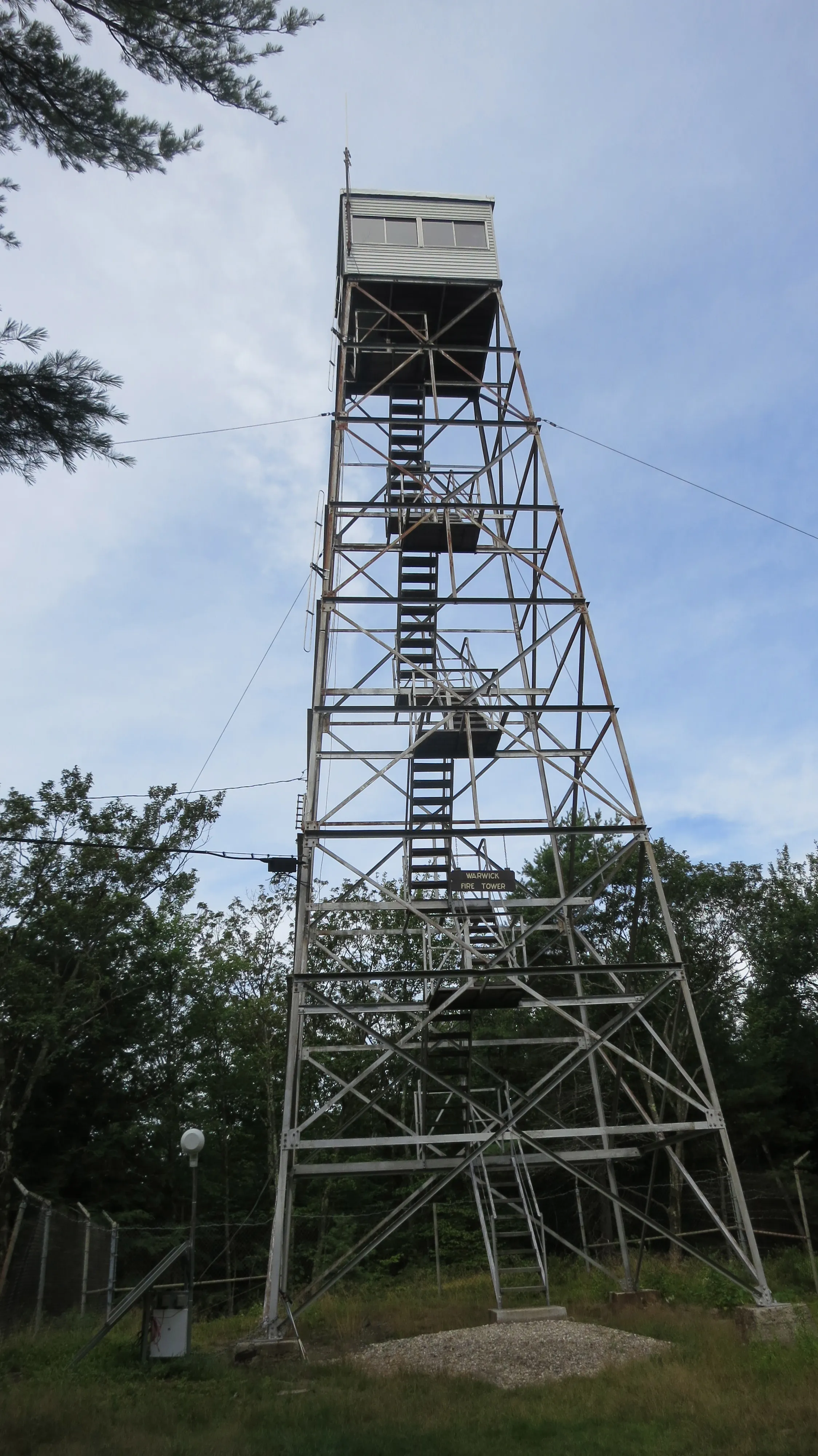
The current tower is a 68-foot steel lattice with a small wooden cab, built in 1939 after the previous iron tower was blown down in the 1938 hurricane. It is the third tower to stand on the summit, and it is still an active state lookout, staffed by DCR during fire season (typically March through May and again from late August into October, depending on conditions). The cab is listed on the National Historic Lookout Register. When the tower is open, the climb adds the last twenty feet or so of elevation and pushes the view above the trees: Mount Monadnock to the north in New Hampshire is the dominant landmark, with the rolling hill country of north-central Massachusetts and southern New Hampshire spreading out in every other direction.
Trails and the M-M / NET
The 114-mile Metacomet-Monadnock Trail (the Massachusetts section of the New England National Scenic Trail) climbs over the Mount Grace summit, and the M-M is the simplest way up. The common starting point is the trailhead lot on Route 78 (Winchester Road), where the M-M crosses the highway near the remains of the old Mount Grace 20 Club ski area. From there it is a steady climb of roughly a mile and a half to the summit, and the same back; pairing the M-M with the Round the Mountain Trail makes a longer loop of about five miles. A primitive lean-to shelter on the east side of the mountain is open for backpackers using the M-M as a long-distance route.
Forest trails are also open to horseback riding, mountain biking, cross-country skiing, and snowshoeing; the property is more multi-use than most DCR mountains in the valley.
A bit of history
The land was purchased by the Commonwealth as a state forest in 1920. Picnic and ski facilities were built starting around 1930, much of it Civilian Conservation Corps work in the Depression years. The small 20 Club ski area ran on the mountain’s lower slopes from roughly 1952 into the early 1970s; a rusted lift tower and concrete footings near the Route 78 trailhead are what is left of it.
The mountain is traditionally said to be named for the infant daughter of Mary Rowlandson, the colonial captive whose 1682 narrative is one of the best-known accounts of King Philip’s War. The legend has it that the child was buried at the foot of the mountain on the march north. Historians have noted that Rowlandson’s narrative names her surviving daughter as Sarah, not Grace, so the naming story is at least partly folklore. Either way, the name has stuck since the 19th century and now belongs to the mountain, the forest, and the local Warwick-based Mount Grace Land Conservation Trust that works across the surrounding hilltowns.
What to know
- No facilities: no water, no bathrooms, no ranger station. Pack out what you pack in.
- Dogs: DCR allows dogs off leash on trails when they are at least 100 feet away from recreational areas.
- Tower access: the stairs are open whenever the tower is not closed for maintenance, but the cab itself is locked except when staffed.
- Hunting: the forest is open to hunting in season; wear blaze orange in November.
- Getting there: Route 78 out of Orange to the south or down from the New Hampshire line; Northfield to the west by way of Route 10 and Warwick center.