Chester is a small Hampden County hill town of about 1,200 in the West Branch Westfield River valley, where U.S. Route 20 and the active CSX rail line climb out of the Connecticut Valley toward the Berkshires. The town was incorporated as Murrayfield by the Massachusetts General Court on October 31, 1765; the name was changed to Chester by an act passed on February 21, 1783, after the town petitioned the General Court to distinguish itself from a similarly-named neighbor.
The Western Railroad and the 1841 station
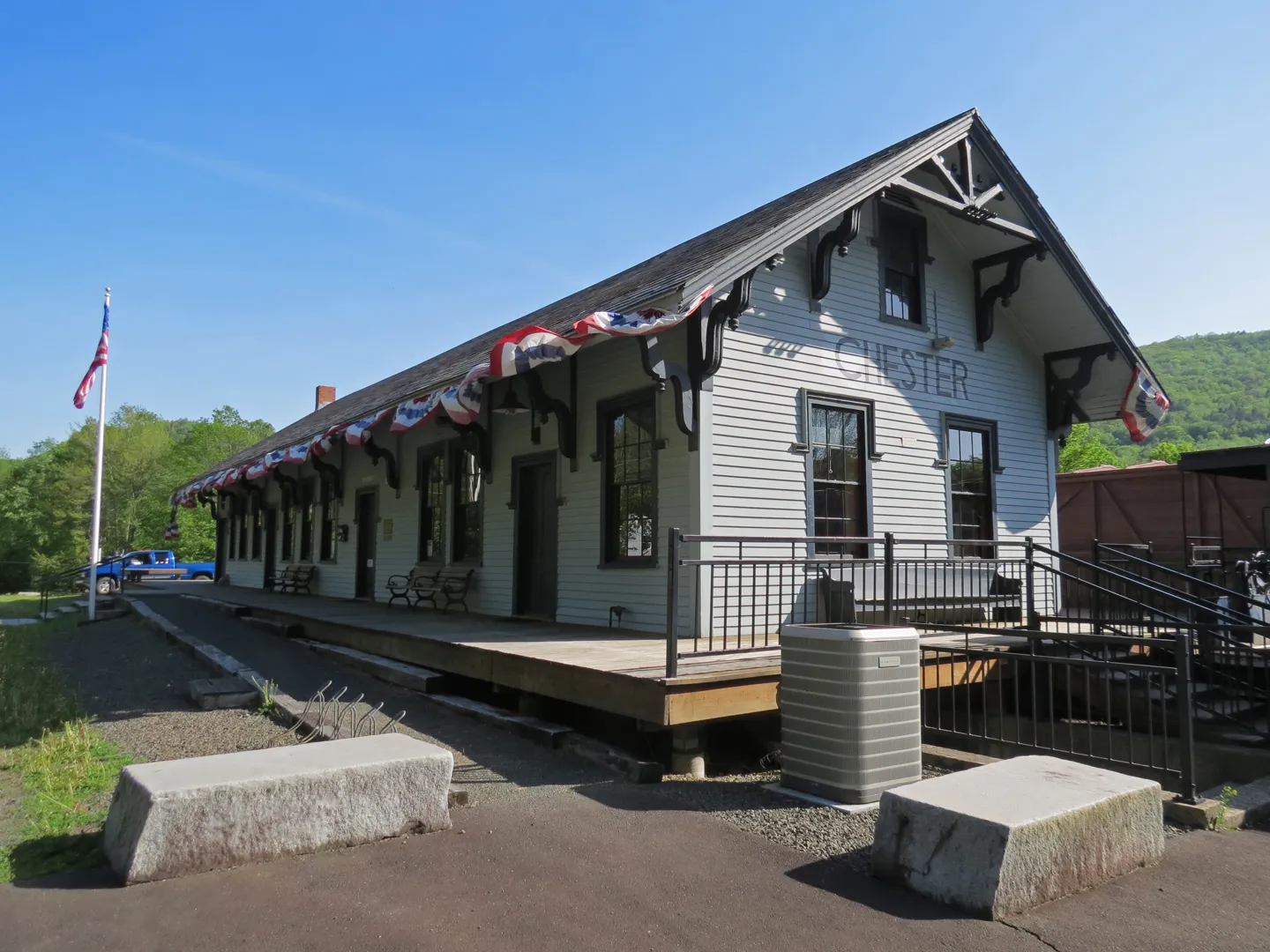
The hero image is the Chester Railroad Station, a wood-frame depot built in 1841 for the Western Railroad, the pioneering Boston-to-Albany line whose Berkshire crossing was, at the time of its 1841 completion, one of the most ambitious pieces of railroad engineering in the United States. The line opened to Chester on May 24, 1841. The station building survived as a working depot into the mid-20th century and is now the Chester Foundation Museum (also called the Chester Railway Station Museum), an all-volunteer museum dedicated to the construction and history of the Western Railroad through the Westfield River valley. The active CSX main line still runs immediately behind the station building.
The Keystone Arch Bridges
To carry the Western Railroad’s original 1841 alignment up the narrow gorge of the West Branch Westfield River between Chester and Middlefield, the line’s engineers built a sequence of dry-laid granite arch bridges (the Keystone Arch Bridges) which remain the most distinctive engineering monument in town. Five were built in 1840–1841 and at least three survive in good condition, including the largest, a roughly 70-foot single arch nearly 80 feet above the river. The bridges were superseded in 1912 by a straighter alignment along the river (the line CSX runs today), and the abandoned 1841 cut was eventually opened as a hiking trail.
For the hike itself, see the Keystone Arches Trail entry.
Chester-Blandford State Forest and Sanderson Brook Falls
South of U.S. Route 20, the Chester-Blandford State Forest, about 2,800 acres straddling the Chester-Blandford line, preserves a section of the upland plateau between the Westfield River and the Berkshire foothills. The forest’s headline feature is Sanderson Brook Falls, a 60-foot cascade on a small tributary of the West Branch Westfield. The trail to the falls is a roughly 1.5-mile walk on a gated former Civilian Conservation Corps service road that leaves Route 20 in Chester. The CCC built much of the forest’s road, bridge, and pavilion infrastructure between 1934 and 1940; the forest itself was established in 1924 from former lumber-company holdings.
Geography and the river
Chester is one of the larger hill towns by area (about 37 square miles), and the West Branch Westfield, the Middle Branch Westfield, and several smaller mountain brooks all run through it. The upper Westfield system is a federally-designated Wild and Scenic River, the first such designation in Massachusetts, and the upper West Branch through Chester is part of that designated reach.
The town is bounded by Middlefield to the north, Worthington to the northeast, Huntington to the east, Russell and Blandford to the south, and Becket (across the Berkshire County line) to the west.
Other notes
- The 1893 Chester train wreck, in which 14 people were killed when a railroad bridge collapsed under a passenger train, is one of the worst rail disasters in the town’s history and is still marked locally.
- The historic village center along Main Street and Maple Street includes the Hamilton Memorial Library and the Second Congregational Church (1840s, NRHP-listed).
- The Littleville Dam flood-control reservoir sits on the Middle Branch Westfield in the eastern part of town, part of the same U.S. Army Corps system as the Knightville Dam in neighboring Huntington.