Ludlow is a Hampden County town of about 21,000 on the north bank of the Chicopee River, immediately east of Springfield and north of Chicopee. The town was settled in the mid-18th century as the Stony Hill district of Springfield and was set off and incorporated as the separate town of Ludlow on February 28, 1774, a separation driven mainly by the difficulty of crossing the Chicopee River for civic business in the parent town.
Ludlow Mills
The defining 19th- and early-20th-century institution in town was the Ludlow Manufacturing Company (later Ludlow Manufacturing Associates), which opened a mill on the Chicopee River around 1868 and grew into one of the largest jute-spinning operations in the country, producing twine, yarn, webbing, and burlap. The company built much more than a factory: it laid out worker housing, a library, schools, and playgrounds in the southwest corner of town, and the Ludlow Mills complex along the river became the commercial center of Ludlow as the older Ludlow Center on the hill above quietly faded. The company eventually moved its jute operation to India. Today the Ludlow Mills complex is in long-term redevelopment as a mixed-use riverfront district, with surviving brick mill buildings adapted for housing, offices, and small-scale manufacturing.
The Portuguese-American community
Ludlow has the largest Portuguese-American community in Western Massachusetts. By recent census estimates roughly a fifth of the town’s population claims Portuguese ancestry, much of it tracing back to Azorean and mainland-Portuguese immigration through the 20th century, drawn in significant part by mill work. The community’s institutions are visible across town: Our Lady of Fátima parish on Winsor Street, with its large annual summertime Festa; the Ludlow Portuguese Club and several Portuguese-American social clubs; Lusitano Stadium, home of the longstanding Ludlow Lusitano soccer program; and a number of bakeries and markets carrying Portuguese breads, pastries, and groceries.
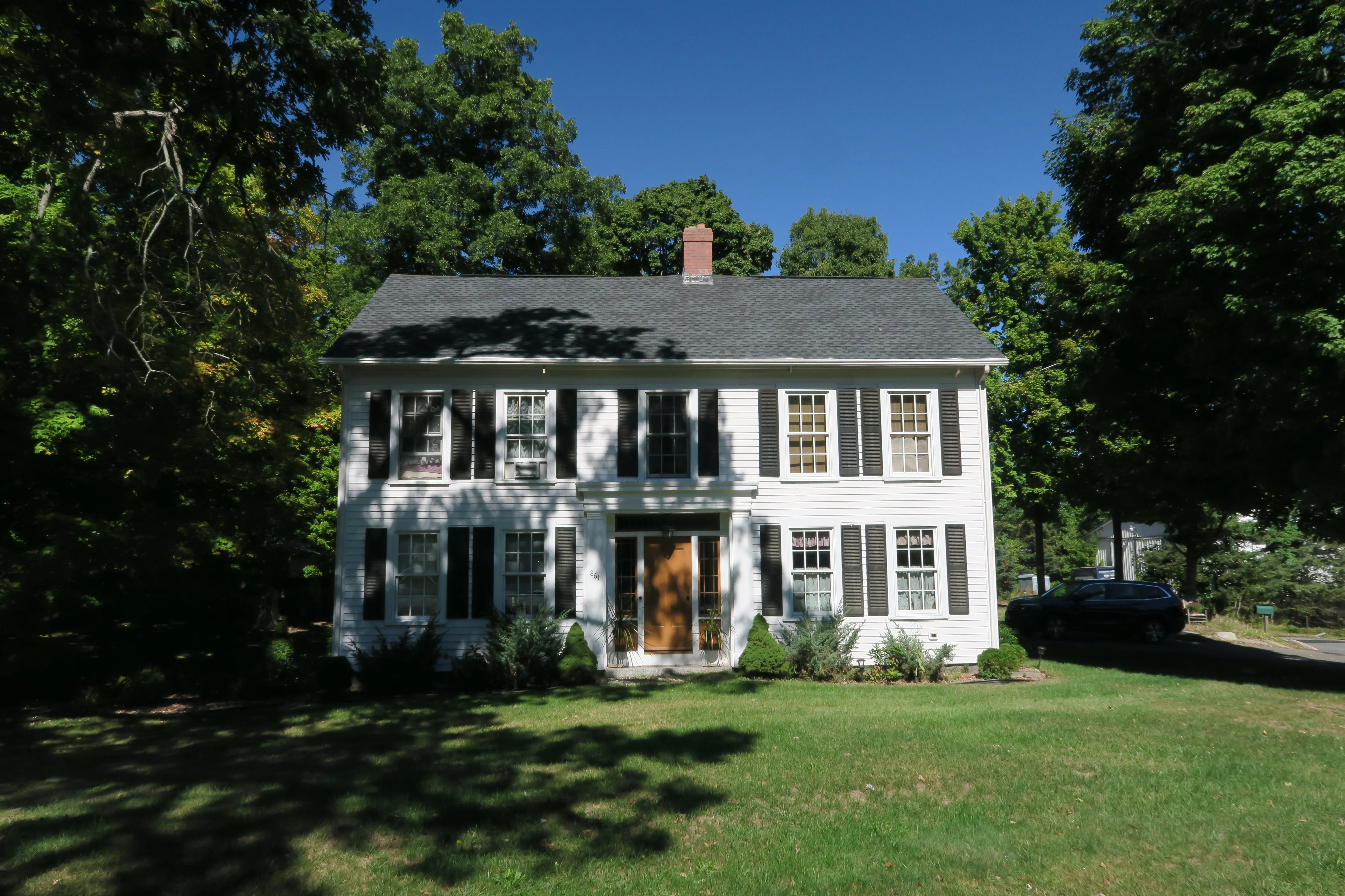
Ludlow Center
The pre-industrial center of town is Ludlow Center, the small hilltop village along Center Street north of the mills, built around the original 1783 meetinghouse and a small triangular common at the junction of Center, Church, and Booth streets. The hero image is the Increase Sikes House on Center Street, one of the surviving 19th-century houses of the village. The cluster of twelve or so buildings around the common, including the 1859 Romanesque-style Congregational church and the old town hall later used as a grange, was listed as the Ludlow Center Historic District on the National Register of Historic Places.
Ludlow Reservoir
Most of the northern third of Ludlow is taken up by the wooded watershed of the Ludlow Reservoir (also called the Cherry Valley Reservoir), a holding reservoir in the Springfield Water and Sewer Commission system that supplies drinking water to Springfield and several neighboring towns. The reservoir’s perimeter road and the woods around it are open to walking and cycling under the commission’s rules, and the loop is one of the most popular flat outdoor walks in the Springfield area.
Other notes
- The town is bounded by Chicopee to the west, Springfield to the southwest across the Chicopee River, Wilbraham to the south, Belchertown to the north, and Granby and Palmer to the northeast and east respectively. (Westover Air Reserve Base, often associated with the area, is across the line in Chicopee, not Ludlow.)
- The Massachusetts Turnpike (I-90) runs east–west across the southern part of town; Exit 54 in Ludlow is the local Turnpike interchange, and the area around it has filled in with hotels, restaurants, and the eastbound and westbound Ludlow Service Plaza.
- The Stony Brook Power Plant in the south of town was, on its 1981 construction and conversion in the early 1980s, an early combined-cycle generating station in Massachusetts.
Sources
- Town of Ludlow
- Ludlow, Massachusetts — Wikipedia (2020 U.S. Census population: 21,002)
- Ludlow Center Historic District — Wikipedia
- Ludlow Mills (Westmass) redevelopment